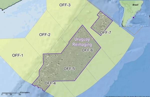
Viridien has kicked off the Charrua 3D multi-client seismic survey offshore Uruguay, marking a new phase of exploration activity in the country’s offshore basins.
Data acquisition will be carried out by the vessel BGP Prospector, with the company applying seismic imaging technologies including time-lag full-waveform inversion (TLFWI) to produce high-resolution subsurface images.
The survey expands Viridien’s multi-client seismic data coverage and reflects growing industry interest in the southern Atlantic Margin, where offshore basins in Uruguay share geological similarities with Namibia’s Orange Basin.
Recent discoveries in Namibia’s Orange Basin have confirmed the presence of a working Aptian petroleum system, contributing to exploration interest in analogous basins across the South Atlantic.
The Charrua survey is supported by industry funding.
“We are proud to support Uruguay in unlocking what we believe is one of the next great energy frontiers. The Charrua survey marks a major milestone for Viridien as we deploy our most advanced seismic imaging technologies to deliver high-resolution data needed to de-risk exploration," said Dechun Lin, Head of Earth Data at Viridien.
 Subscribe