The massive Libra pre-salt area, which was originally believed to contain at least volumes of between 8 billion and 12 billion boe, started production at the end of 2017. Located within the Santos Basin, over 200 kilometers off the coast of Rio de Janeiro, Libra covers an area of 1,550 square kilometers and is located in ultra-deep waters, at a depth of around 2,000 meters. Although located offshore the highly developed Southeast coastal states of Brazil, the Santos Basin still lacks dedicated historical ocean measurements, especially in deeper regions, which prevents researchers from better understanding many aspects of the oceanographic features of this area, such as the Brazil Current System and its associated eddies and meanders, according to researchers from Coppe / UFRJ and Prooceano (Brazilian oceanographic technology company, which since 2012 belongs to the CLS Group headquartered in France).
Now, this offshore area is receiving fresh scientific research and development projects, through a partnership with the Laboratory of Computational Methods in Engineering (LAMCE) Coppe / UFRJ and Prooceano. Shell will invest up to $10 million in the project “Developments and Innovations in the Santos Basin Oceanic System with Focus on the Libra Field - Project Azul Phase II”.
The goal is to increase the resolution of oceanic models by enabling less conservative design and operating guidelines in the various stages of development of an oil field - drilling, production, offloading and abandonment. With investment planned for the next four years, the project will use autonomous surface and underwater vehicles for data collection, which will be compared to more traditional methods of measurement.
An instrumented monitoring merge line will also be installed in the Libra Field, allowing complete time series at fixed points, which will complement the data collected by the autonomous vehicles.
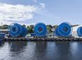
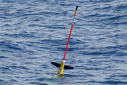 A glider deployed for Project Azul (Photo: Prooceano)
“We are on the verge of undertaking the first launch of submarine gliders of the second phase of the Project Azul, which will focus on the high resolution operational ocean forecast for the Santos Basin,” said Francisco dos Santos, coordinator of the Projeto Azul at Prooceano. “The launching of an autonomous surface vehicle and two instrumented mooring lines are planned for this year. These platforms will be responsible for the observation of waves and currents and will allow to evaluate the results of the numerical forecasts.
“The data and results of this project have the potential to support operations in the pre-salt cluster, from the exploration phase to the production development phase, increasing the operational availability of equipment and facilities, improving the efficiency and safety of maritime operations, and supporting preparedness and response actions in emergency situations.”
Project Azul - Phase II is a continuation of the first phase, which aimed to develop a pilot Oceanic Observation System (OOS) for the Santos Basin region based on autonomous platforms and data assimilation on numerical models and will be financed with resources from the research and development clause of the concession agreements of the National Agency for Petroleum, Natural Gas and Biofuels (ANP). During Phase I, which started in 2013, the project pioneered the operation of ocean gliders offshore Brazil.
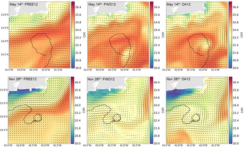
In addition, an assimilation system for the data collected by the gliders and several other sources were successfully implemented in a numerical prediction model for the region, which has already been an important asset for regional forecasts.
Francisco dos Santos stressed that “Projeto Azul Phase II will focus on operational ocean forecasts of high-resolution, made possible by the assimilation system developed during Phase I.
“Phase II will also evaluate different wave data collection instruments, including an autonomous surface vehicle.” he added.
All data collected will be available for noncommercial use, benefiting researchers and institutions interested in doing more research in this area. “The new oceanographic data set and the new numerical modeling tools of the Santos Basin Ocean Observational System will be comparable to the most advanced systems in the world and will put Brazil at the forefront of physical oceanography,” said Prof. Luiz Landau, Coordinator of the Laboratory of Computational Methods in Engineering (Lamce) of Coppe / UFRJ.
Being the region that concentrates the main discoveries in the pre-salt, the understanding of the ocean dynamics is essential for structures dimensioning, the planning of activities and for the safety of offshore operations.
 Subscribe