There is more to 4D technology than just exploring for oil and gas. It can also be used to monitor the storage of carbon dioxide and methane in offshore reservoirs in the North Sea. Heather Saucier finds out more.
 |
|
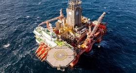
Statoil boasts a 59% recovery rate at the Gullfaks field in the Norwegian sector of the North Sea. The first 4D seismic was shot there in 1995. Photo: Harald Pettersen – Statoil. |
More than three decades ago, 4D seismic technology was merely an academic research topic. Today, it has become one of the most effective technologies – not only for identifying an offshore reservoir’s remaining oil and boosting recovery rates, but also for monitoring the storage of gases, such as carbon dioxide and methane, in the seabed.
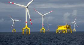
The success of 4D seismic is most notable in the North Sea, an area which has been a natural laboratory for testing and advancing the technology to the point of worldwide recognition.
“The recovery efficiency in many fields in the North Sea was running in the earlier days at 30-35%. Now, we are starting to get 50-60% recovery rates,” notes John Underhill, Shell Centre for Exploration Geoscience at Heriot-Watt University in Edinburgh, Scotland.
Statoil, which has used 4D seismic technology for roughly 25 years, recently placed an estimated net value of US$4 billion on the assets it monitors in the North Sea.
“Given the huge net value that can be directly attributed to applying 4D seismic and the growing need to monitor carbon dioxide storage projects, the demand for 4D seismic will undoubtedly grow,” says Paul Brettwood, vice president of technology at ION Geophysical.
 |
|
On Gullfaks alone, 4D seismic surveys have contributed to 62 MMbbl of additional production. The technique is based on comparative results of 3D seismic surveys, providing quantitative imaging for production of oil saturation maps. |
The fourth dimension
Also known as “time-lapse technology,” 4D seismic involves the acquisition, processing and interpretation of multiple 3D seismic surveys taken at different points in time – which adds the fourth dimension to the process.
Each 3D survey is taken over the same area of a producing field to monitor changes caused by reservoir production in the subsurface.
 |
|
Underhill. |
The first step in the process requires shooting a 3D baseline survey, Underhill explains. After a period of time, an identical survey is shot using the same acquisition and processing parameters. By subtracting the second survey from the first, one can see changes in fluid saturation and pressure caused by the depletion of a reservoir over time.
These changes can help operators detect missed pockets of oil or water encroaching toward a well. Based on that information, choices can be made to drill infill wells or shut in wells, resulting in more effective reservoir management, Underhill says.
“You can actually see from one ‘moment’ to the next,” Underhill adds, explaining that “moments” are often years apart.
Five years seems to be the ideal length of time in terms of cost-benefit analysis, Underhill says. Over a 20-year period, four 3D surveys should be sufficient – depending on the reservoir, of course. The amount of change one might see in one year does not justify shooting frequently, as 3D surveys are multi-million dollar operations, he explains.
“However, the expense of this technology more than justifies itself because you are managing fields far better,” he says. “You get more oil out of the ground in the long run.”
Qualitative to quantitative
In 4D seismic technology’s early stages, its accuracy was limited, keeping it a qualitative tool, primarily used to interpret internal reservoir structures and to identify depleted or “unswept” zones, according to CGG, a French seismic and data processing firm.
However, advances in 4D processing, in particular, have turned the technology into a quantitative reservoir management tool, with the ability to make more accurate assessments about fluid saturation and pressure.
“This technology has contributed to increased hydrocarbons at the Statoil-operated Gullfaks field [in the Norwegian sector of the North Sea] valued at $950 million (net present value),” according to Statoil’s website. The North Sea’s Brage field off the coast of Norway has been in production since 1993 – its life extended with the help of 4D seismic’s ability to assess remaining hydrocarbon volumes and optimize a recovery strategy, CGG reports.
The company adds that time-lapse technology has “very real” budgetary consequences and “significant” revenue implications.
When appropriately used in the right reservoirs, the cost of the additional oil recovered has been reported to be as low as $1/bbl, Brettwood says.
Not only can time-lapse technology optimize production in terms of recovery and cost, it can help increase safety and reduce environmental impacts, he adds. For example, in the event of an internal blowout, 4D seismic can provide information on where reservoir fluids are moving and where relief wells might best be placed. Similarly, in a carbon dioxide or methane storage situation, 4D seismic allows the user to track fluid movement through the storage formations and therefore be in a position to prevent the potential breaching of seals.
Underground storage
 |
|
Brettwood. |
Many of the oil fields in the North Sea are mature and in relatively shallow water, making them ideal for detecting residual oil, unlike deepwater locations that can weaken and distort seismic signals, Underhill says.
Furthermore, the soft and clastic fields of the North Sea are more conducive to analyzing changes in fluid saturation, pressure, porosity and stress than in the hard carbonate reservoirs of the Middle East, for example, Brettwood explains.
An abundance of mature oil fields also have made the North Sea an ideal testing ground for subsurface storage projects, such as using depleted reservoirs to store carbon dioxide and methane.
“One of the earliest and most successful carbon dioxide storage examples is at the Sleipner field in the North Sea,” Brettwood says. “The monitoring there has confirmed that the carbon dioxide remains in the sand unit into which it is injected.”
Combining 4D seismic results with other monitoring methods, such as time-lapse gravity and electromagnetics, should also provide the data needed to verify the amount of carbon dioxide stored, as well as its areal extent,” Brettwood adds.
What’s next?
While 4D seismic technology has been successfully proven in shallow fields, acoustic signals often get weak or distorted in deepwater.
Efforts are being made to improve 4D signal-to-noise ratios to detect weaker 4D signals, Brettwood says. Improvements are being made in areas including acquisition, processing and inversion of 4D seismic data.
In terms of acquisition, more accurate positioning of the seismic sources and receivers will allow for better repeatability of the survey by reducing the level of 4D noise (the sum of all non-repeatable effects not linked to production- or injection-induced effects).
A new approach to data processing includes addressing all 3D datasets simultaneously – in a “global optimization approach” – rather than as a series of separate sets that are processed using the same flows and parameters.
In terms of offshore subsurface storage, technology is advancing in that field as well. Areas of advancement range from improved particle motion sensors and more accurate algorithms to innovative ideas. These ideas include the work on muon tomography (a technique that uses cosmic ray muons – or small, charged particles – to generate 3D images of volumes) by Professor Jon Gluyas at Durham University in England, Brettwood says.
Other areas aim to provide an inexpensive, continuous and passive monitoring methodology that is directly sensitive to carbon dioxide density.
“The injection of carbon dioxide into a reservoir can create a very complex wavefield that requires sophisticated imaging and velocity-model building techniques, such as full waveform inversion or 4D elastic imaging,” Brettwood says.
All of these acquisition and processing technologies are improving and maturing and allowing finer details and smaller changes in the reservoir to be seen.
“There are definitely people investing time and energy into improving time-lapse seismic,” Underhill says. “In the North Sea especially, the environment is very conducive to this type of analysis as well as a large prize.”
 Subscribe