ION Geophysical announced a new 2D multi-client program offshore Gabon, EquatorSPAN II, in cooperation with the Gabon Ministry of Petroleum and Hydrocarbons, Direction Général des Hydrocarbures of Gabon (DGH).
 |
|
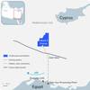
Map of EquatorSPAN, from ION. |
The program includes over 1900km of new high-quality, deeply-imaged seismic data and is supported with industry prefunding.
ION says that EquatorSPAN II addresses the need for greater understanding of geologic conditions and basin evolution in support of future offshore license rounds. The program will image the deep basin architecture, define the limits of the various basins along the equatorial margin and identify potential petroleum systems. In addition, EquatorSPAN II integrates available offshore well data to regionally calibrate key stratigraphic horizons.
EquatorSPAN II is the newest addition to ION's data library, which includes over 500,000km of 2D data and over 100,000sq km of 3D data in exploration and production hot spots around the world.
The program will tie to existing ION data sets including EquatorSPAN I, CongoSPAN and NigeriaSPAN to enhance the West African regional framework.
"Deepwater oil exploration offshore West Africa has thrived over the last 20 years and this region remains an important component of many E&P companies' exploration portfolios,” says Joe Gagliardi, SVP of ION's Ventures. “In conjunction with existing and planned BasinSPAN surveys in adjacent countries, EquatorSPAN II will enhance the knowledge of the entire basin."
 Subscribe