Andrew McBarnet picks up on the growing enthusiasm for modern gravity gradiometry surveys to assist E&P oil and gas operations
 There’s definitely something stirring in the full-tensor gravity gradiometry (FTG) market for airborne and vessel surveys over onshore and offshore targets, based on significant advances in gravity measurement for E&P developed in the last 15 or so years. Much of the recent high-profile activity has centered on supporting oil company early reconnaissance of prospects in East Africa, where identification of unsuspected new hydrocarbon plays has taken the industry completely by surprise.
In this context, FTG is increasingly recognized as a valuable method to survey large areas of exploration interest where there is little or no seismic data available and where large-scale seismic surveys may be impractical because of the type and size of the terrain.
According to ARKeX, UK-based provider of FTG services, East African geology, essentially comprising relatively young sediments juxtaposed against a (much denser) Archaean basement, was ideally suited for gravity gradiometry technology. Operators (Tullow, Africa Oil) have acquired large FTG surveys over Kenyan and southern Ethiopian holdings to assist their exploration activities. FTG is used to measure variations of the Earth’s gravity field with such a high degree of resolution and bandwidth that detailed basement structure maps can be derived. This facilitates optimal positioning of a seismic campaign, according to ARKeX. As an airborne technique, FTG surveys can be acquired efficiently and rapidly over large areas with the additional benefit of a negligible environmental footprint. Further down the line, early seismic acquired in a basin can be calibrated to the FTG data and if necessary, the seismic program can be modified to take account of shallow basement or insufficient depth of burial of potential source rocks.
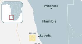
Offshore Mozambique, ENI and Anadarko have been leading the charge with substantial gas discoveries. In 2011, the Instituto Nacional de Petróle (INP), which manages the country’s oil and gas resources, announced tenders for seismic and FTG multi-client surveys. In April 2013, WesternGeco, winner of the main seismic tenders, began a 2D, long-offset, multi-client survey of more than 31,000km. This covers most of Mozambique’s offshore territory, where future licensing rounds are expected. ARKeX was chosen to carry out the FTG multi-client campaign, beginning with a planned survey over the Beira High, but a start date has not yet been announced. The company has also been in the bidding fray for a similar government-inspired project off Sri Lanka.
High-resolution, high-bandwidth FTG surveys are applicable not only to these frontier exploration areas, but have also been used in areas dominated by complex salt structures. For example, ARKeX has carried out both marine and airborne FTG surveys off- and onshore West Africa to provide valuable control data for mapping salt structures and thereby aiding the seismic interpretation. Ophir, Svenska, CGGVeritas, and Maurel et Prom have all acquired FTG surveys to aid their seismic interpretation and imaging. In these cases, density contrasts resulting from salt emplacements in denser surrounding sediments and carbonates create large signals in the FTG data that can aid the interpretation of seismic often characterized by low acoustic impedances. In the Red Sea, an ARKeX marine FTG survey in three blocks off the western coast of Saudi Arabia were intended to improve the definition of the top and flanks of salt bodies within the survey area. The FTG data was able to enhance geological and velocity model building, and to improve overall 3D seismic imaging, the company says.
There are plenty of other clues suggesting the technology is gaining traction in the oil and gas industry, including a surge of meetings and research papers over the last few years, many focused on data modelling and improved integration with other E&P data. A more practical indication is that CGG has shown every sign of being excited by its acquisition of Fugro Airborne Surveys (still to be officially signed off). This unit, which has an ongoing FTG operation, was included in the package when CGG bought the Fugro geoscience division earlier this year: word from CGG is that it only sold off its airborne geophysical services 13 years ago (to Fugro) because of belt tightening during the 1999–2000 seismic market downturn.
 For oil and gas operations, CGG may be looking with interest at a joint project undertaken by ION Geophysical and ARKeX offshore northeast Greenland as a potential model for its own multi-client activities in the future. The idea was to integrate a 2D seismic GreenlandSPAN survey carried out by ION with ARKeX FTG data to create a 3D structural model of the northeast Greenland passive margin.
In August last year, ARKeX completed the FTG segment, offshore northeast Greenland. The 50,000sq km, multi-client survey for ION is said to have been the largest single offshore FTG survey ever undertaken. It actually had to be flown by Bell Geospace because it was the only company with a plane suitable for the long-distance flights required. The survey included key areas of the pre-round blocks that are on offer initially to the KANUMAS group and then in the ordinary licensing round this year offshore Greenland. The FTG data has been integrated and jointly interpreted with ION’s 2D data to provide a better understanding of the structural development of the region.
In its strategy going forward from the Fugro purchase, CGG is known to be thinking of a more aggressive approach to multi-client survey work. It makes sense that it should be contemplating projects that can integrate gradiometry surveys with seismic datasets. Such a strategy also conforms to CGG’s new positioning as the only ‘integrated geoscience company’ offering a complete portfolio of geophysical applications, seismic and non-seismic.
The company has the FTG tools because it is inheriting the Falcon Airborne Gravity Gradiometer (AGG) system, employed by Fugro Airborne Surveys. Falcon systems have clocked up over 2 million survey-line km worldwide, mainly but not exclusively for mineral exploration, either for direct resource detection or geological mapping.
The Falcon story is part of industry folklore about how FTG came into commercial use. During the 1970s, as an executive in the US Department of Defense, John Brett is said to have initiated the development of the gravity gradiometer to support the Trident 2 submarine system. It would be the first gradiometer that could work on a moving platform. A full FTG system was deployed on US Navy Ohio-class Trident submarines designed ostensibly for covert navigation, but most probably also for the passive detection of gravity field changes that might indicate the presence of a silent enemy submarine. The movie “The Hunt for Red October” alluded to the technology. Whatever the purpose, the FTG system was developed by Bell Aerospace, Niagara Falls, NY (later acquired by Lockheed Martin). With the end of the Cold War, the US Navy released the classified technology and opened the door to full commercialization.
Lockheed Martin’s research included an airborne test, in 1986, of the FTG system called the Gravity Gradiometer Survey System (GGSS). While the GGSS did measure real gravity gradients, the noise levels were high. Mark Dransfield of BHP Billiton recalled at a 2007 mining conference that the test was performed using a system mounted in a Winnebago, which was driven into a Hercules C-130 – possibly not an ideal solution.
In 1996, BHP (now BHP Billiton) entered into an agreement with Lockheed Martin to develop a new gravity gradiometer. However, it was based on a technology, newer than the GGSS FTG, developed by Lockheed Martin for an arms verification application. This emerged in the industry as the Falcon AGG, initially operated by BHP Billiton with its mining interests in mind. In October 1999, the first airborne gravity gradiometry survey was flown over the Bathurst Camp in New Brunswick by Sander Geophysics for BHP Billiton. The Falcon technology was subsequently acquired, in 2007, by Fugro Airborne Surveys. It is a partial tensor system with eight accelerometers and can be deployed in a fixed wing aircraft or a helicopter.
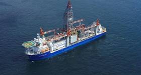
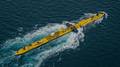
During the 1990s, Bell Geospace independently developed the first marine FTG system using technology also licensed from Lockheed Martin. Those with long memories may recall the razzmatazz that greeted the first surveys. It was eerily similar to the hype that was to greet that other potential methods breakthrough, marine control source electromagnetics (CSEM), just a year or two later. Like the early CSEM operators, Bell Geospace was to experience the dazzling debut followed by a period of doubt, disillusion and financial challenges before redemption for the technology in the form of gradual industry adoption as a mainstream survey option. Between 1998 and 2002 the company focused on surveys in the Gulf of Mexico and northwest Europe, using two Marine-FTG units (equipment costing millions of dollars) mounted on dedicated vessels.
 The main interest at that time was the imaging of salt and basalt features. Gradient data responds to density changes independently of velocity and is not subject to imaging problems caused by the scattering of seismic energy. According to Bell Geospace, FTG technology therefore provided an independent means to resolve subsurface structure by defining the size, shape and thickness of salt and subsalt structure. A well-defined salt feature can be used to provide a more accurate initial velocity model for prestack depth migration, thereby saving iterations, time and money. Gradient data also responds strongly to the presence of basalt. The size, shape and thickness of basalt can be mapped and its signature removed from the seismic data in order to accurately image the sub-basalt structure.
By 1993, Bell Geospace had modified its systems so that it could offer either marine or airborne FTG surveys. In 2005, ARKeX was established by ARK Geophysics and Oxford Instruments based in Cambridge, UK. The idea was to develop and operate the superconducting gravity gradiometer technology being researched and developed by Oxford Instruments. However, the company’s first step was to enter the FTG market with systems similar to the Bell Geospace equipment built by Lockheed Martin capable of both marine and airborne operation.
 Technically, the benefit of the FTG survey arises from using multiple pairs of accelerometers to measure the rate of change of the gravity field in all three directions while a conventional gravity survey records a single component of the three-component gravitational force, usually in the vertical plane. In other words, gravity gradiometers capture the high-frequency signal associated with near-surface lateral density variations more clearly than conventional vertical gravity field instruments. This is explained by the fact that the gradiometer signal strength falls off with the cube of the distance to the target while the conventional vertical gravity signal decays with the square of the distance.
Naturally, the clock has not stopped on the development of more sophisticated FTG survey technology, driven by the desire for increased precision as well as more efficient, less costly operations, but constrained by the stable platform and controlled speed required for the current survey methods. ARKeX recently opened a special test center to accelerate development of its Exploration Gravity Gradiometer (EGG), originally associated with a European Space Agency mission, and now being targeted for high dynamic survey environments. The company says it uses two key principles of super conductivity to deliver its performance: the “Meissner effect,” which provides levitation of the EGG proof masses and “flux quantization,” which gives the EGG its inherent stability. The EGG is designed to operate at 40° above absolute zero (-269°C). This is said to allow greater sensitivity and stability.
Other projects ongoing or reported are the Stanford University Atomic Interferometer (AI) Gravity Gradiometer; Gedex High-Definition Airborne Gravity Gradiometer; University of Western Australia (UWA) Gravity Gradiometer; and the Gravitec Ribbon Sensor. You can also be sure that current operators Bell Geospace and CGG will be continuing to assess the effectiveness of their technology. This is a market that seems destined to grow in scale and scope. OE
 Subscribe