Viridien has announced a new regional multi-client data initiative for the offshore basins of India, designed to deliver enhanced, data-driven exploration capabilities to industry operators.
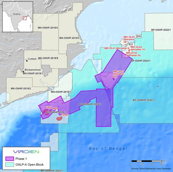
The initiative will start with Phase 1 Mahanadi Basin reimaging and merging of approximately 9000 sq km of 3D seismic data over the offshore East Coast Mahanadi Basin.
Fast-track results will be ready by June 2026, with final data available by the end of 2026.
The aim of the Phase 1 Mahanadi Basin reimaging project is to provide higher-quality imaging over proven petroleum system areas, as well as deeper water areas where exploration of new thermogenic plays has been challenging due to low-quality imaging of legacy data.
Viridien will apply the latest imaging technologies, such as time-lag full-waveform inversion (TLFWI) and least-squares PSDM (LSQPDSM), to address these challenges and produce seamless, high-quality merged 3D datasets.
“The innovative imaging technology and regional expertise provided by Viridien, combined with phased project expansion throughout the Mahanadi Basin, will drive new exploration and investment opportunities for emerging plays, and support both ongoing and future bid rounds,” said Dechun Lin, Head of Earth Data at Viridien.
 Subscribe