Viridien and its partners TGS and Aquila Holdings, under its subsidiary Axxis Multi Client, have completed the reprocessing of the Utsira ocean bottom node (OBN) seismic survey in the Norwegian North Sea.
Utsira is the largest OBN survey conducted on the Norwegian Continental Shelf and required the deployment of more than 144,000 nodes and over 5.5 million shots.
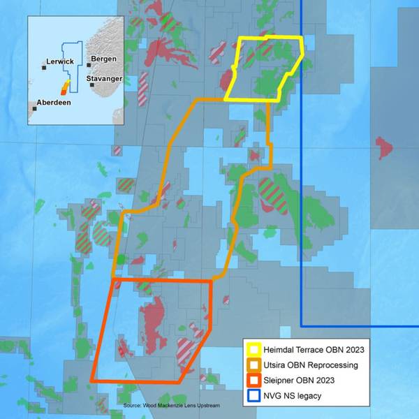
Covering an area of 2077 square kilometers in a mature part of the North Sea, the survey was acquired in 2018 and 2019, and the initial processing results delivered in 2020.
The Utsira area holds several significant oil and gas fields, including Edvard Grieg, Ivar Aasen, Balder, Gina Krog, Gudrun and Johan Sverdrup, along with a number of undeveloped discoveries and prospects.
The reprocessing project has received significant industry support and leverages strong demand for high-definition seismic imaging in this highly prospective area.
Viridien reprocessed the resulting data set with its latest OBN imaging technologies, including time-lag full-waveform inversion, and advanced velocity model building techniques, to yield significant improvements in image resolution and frequency content for fault interpretation and reservoir characterization workflows.
“Through the reprocessing of this OBN data, TGS, in collaboration with Viridien and Aquila Holdings, can equip our clients with the resources to unlock the full potential of this well-established and highly productive petroleum basin. Whether through uncovering new reserves or optimizing current operations, this data offers valuable insights that will greatly enhance understanding of the region,” said David Hajovsky, Executive Vice President of Multi-Client at TGS.
“The new time-lag FWI model and resulting high-resolution images improve fault interpretation and reservoir characterization, enabling operators to make more informed exploration, production, and reservoir management decisions,” added Dechun Lin, EVP, Earth Data, Viridien.
 Subscribe