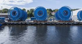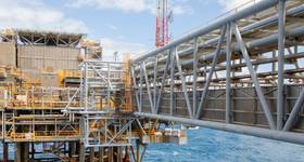
The Australian offshore oil and gas safety regulator NOPSEMA has approved Inpex's plans for 2D seismic surveys offshore W. Australia.
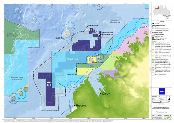
Inpex's proposed survey will cover the WA-532-P and WA-533-P offshore blocks in the Browse and Offshore Canning Basins, as well as the Production Licence WA-50-L, also within the Browse Basin.
At the closest point, Japan-based Inpexs will carry out the survey activity over 87 km west of Broome and 42 km offshore from the Dampier Peninsula. Seismic data acquisition will mainly take place in water depths between approximately 50 m and 600 m below mean sea level.
However, some seismic data acquisition may occur in shallower areas located at Lynher Bank in the southern part of WA-532-P where the shallowest water depth is approximately 30 m, and east of WA-533-P where the shallowest water depth is approximately 37 meters.
The survey will be undertaken by a seismic survey vessel towing an underwater seismic source and a single streamer behind it. The seismic source will be towed behind the vessel at water depths of approximately 5-10 meters.
The seismic source will use compressed air to emit regular pulses of sound which reflect off the seabed and underlying geological rock formations and structure boundary. The reflected sound will be received by the streamer, which may be up to 6-10 km in length and will be towed behind the survey vessel at a water depth of approximately 5-15 m.
According to NOPSEMA, based on the environmental risk assessments presented in the Environment Plan (EP), an acceptable window of opportunity was determined to be from November 1 to May 31 in any calendar year that the EP applies.
In the event that seismic acquisition is unable to commence on 1 November 2021 due to prolonged COVID-19 restrictions, further provision to start the activity in November 2022 or November 2023 has been allowed for in the resubmission, as follows:
• 1 November 2021 – 31 May 2022 (planned acquisition)
• 1 November 2022 – 31 May 2023 (contingency only)
• 1 November 2023 – 31 December 2023 (contingency only).
The seismic survey operation will last approximately 140 days, but to allow for potential adverse weather and operational downtime, the survey may occur over a longer period, and so the survey vessel may be present in the Operational Area for up to 210 days, NOPSEMA said.
 Subscribe