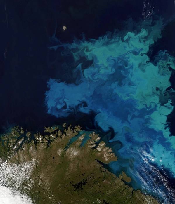
France-based seismic data company CGG has said that its Satellite Mapping group recently completed a high-resolution hydrocarbon seeps study commissioned by the Norwegian Petroleum Directorate (NPD).
The aim of the study was to increase petroleum system knowledge across a relatively data-poor area of the northern Barents Sea.
CGG Satellite Mapping's SAR satellites acquired a large collection of high-spatial-resolution SAR imagery at a high revisit frequency.
Subsequent processing and analysis by its CGG experts identified the presence of small-scale naturally occurring seepage slick features, unlocking, what CGG says is valuable subsurface intelligence.
Richard Burren, Director of Satellite Mapping, CGG, said: “By applying our world-leading remote sensing knowledge to imagery delivered by the latest satellite missions our Satellite Mapping group provides clients with previously unobtainable insights into the presence and behavior of natural seepage in offshore environments.
"These studies hold great value for increasing geologic system knowledge and decreasing risk, which is of particular interest across marginal areas of mature basins at present. They also complement our Seep Explorer product, the industry’s only integrated global onshore and offshore seeps database for regional-to-target subsurface source de-risking.”
 Subscribe