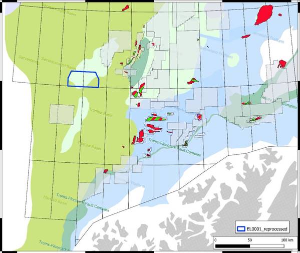
Norwegian seismic data company Geoprovider has released its first multi-client reprocessed 3D seismic dataset in the Western Barents Sea, offshore Norway.
According to Geoprovider, the reprocessed broadband data covers 900 km2 of the Veslemøy High and reveals a working petroleum system and interesting prospects related to the 340 km2 megaclosure.
"Strong direct hydrocarbon indicators have been confirmed using angle stacks, gathers, and multiple models. A full prospect evaluation, including advanced mud gas analysis, supports the presence of high-value targets, to feed into the new infrastructure of the Barents Sea," the company said.
Geoprovider's database now comprises over 100 000 km 2D and 900 km2 of 3D data from the Norwegian continental shelf
 Subscribe