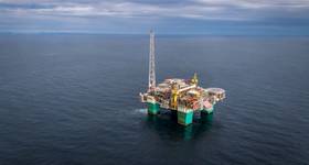
Octanex N.L. announced that OMV New Zealand Ltd. has completed the planned 2D seismic survey, named Mohua, in the Taranaki basin off New Zealand.
OMV has confirmed the survey vessel, Aquila Explorer, commenced acquisition of the Mohua survey on 19 April, and was completed on 22 April.
The survey was shot using a 8km streamer and acquired 203.65km of new 2D seismic data within and adjacent to the permit.
This new seismic survey fulfils the permit's year 3 work program, which is to acquire a minimum of 200km of new 2D data.
The Mohua survey is designed to define leads and prospects in the vicinity of the Kahurangi Trough, with the survey grid acquiring new 2D data over the main leads in the permit, Mohua, Mohuaiti and Mohuanui. It also provides ties lines to the recently drilled Matuku-1 well and the Hector and Matuku 3D seismic surveys previously acquired in the permit and in PEP 51906 respectively.
The participants in the PEP 53537 permit and its joint venture are:
Read More on OE coverage of Taranaki basin: OMV completes Kaka 3D in Taranaki basin
 Subscribe