As part of a three year contract with Lloyd’s Register (LR), the Oil & Gas Authority (OGA) has released their first set of Regional Geological maps and data sets, which cover the UK Central North Sea and Moray Firth.
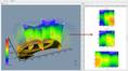
Henk Kombrink, Senior Geologist at LR says: “These maps will be of great benefit to companies seeking to apply for exploration licenses in the upcoming 30th Licensing Round. There are about 100 maps available, varying from depth and thickness grids to well penetration maps and depositional facies maps.”
The maps are offered as an integrated geographic information system (GIS) project as well as layered PDFs. Users will be able to display the maps and data sets in multiple ways or integrate these within their own GIS/Petrel projects – providing a tool for oil and gas operators to effectively look for more exploration opportunities.
Well tops for 1300 quality controlled wells, lithological information for more than 350 wells and hydrocarbon information will be part of the data pack.
Maps and data sets for all remaining areas of the UKCS will also be released, with the Southern North Sea anticipated later this year.
Kombrink says: “Our objective is to provide technical expertise and support to the OGA to help make data freely available, and which helps the OGA to provide industry with a detailed level of insight and up-to-date information on the subsurface of the UKCS. Our work involves collaborating with OGA decision makers to develop long term high-level strategies for managing the UK offshore basins."
Jo Bagguley, Principal Regional Geologist at the OGA, says: “This work forms an important part of our strategy to revitalize UKCS oil and gas exploration. The delivery of this first set of regional geological maps is a key milestone in our plans to deliver a consistent set of geological maps for the whole of the UKCS.”

 Subscribe