A small test offshore Norway could spark a new flame of interest in offshore electromagnetic survey (EM) technology. Andrew McBarnet explains.
Last year you could sense the despondency affecting the two principal proponents of marine controlled source electromagnetic (CSEM) surveys. Both Electromagnetic Geoservices (EMGS), based in Trondheim, Norway, and Offshore Hydrocarbon Mapping (OHM), based in Aberdeen, suffered a traumatic year financially with substantial cutbacks necessary to keep their operations afloat. Some of that pain could be ascribed to the unfavourable economic climate and reduced oil industry E&P budgets. But, more worryingly, the EM story itself has not been unfolding as hoped when the breakthrough technology first hit the headlines 10 years ago with some very optimistic assessments of its value.
Marine CSEM’s early promise was earned as a deepwater tool able to directly detect hydrocarbons in prospects already targeted by seismic survey. The major companies which could afford to operate in deep water had some immediate success with the method, notably ExxonMobil off West Africa. There followed a period where CSEM was tried out in different geological settings around the world. The results were sufficiently encouraging that all the big name marine seismic service contractors saw to it that they had real or potential access to marine CSEM capability.
Meanwhile some small independents spotted an opportunity to participate in UK and Norwegian licensing rounds hoping to leverage the technology to locate previously unidentified pockets of oil or gas.
A combination of factors pricked this initial bubble of enthusiasm for offshore EM, but essentially the technology was oversold in terms of the claims which could be justified on available R&D and operational experience. The providers, understandably wanting to capitalise on a highly significant innovation, got caught up in a spiral of rapid expansion egged on by investors at the time flush with money. The focus was on the capital intensive acquisition of data, mainly vessels and seabed recording equipment (retrievable nodes), and expanding the brand from deepwater application to any water depth.
Yet, after several hundred commercial surveys by EMGS, OHM and WesternGecoEM, mainly proprietary but some multi-client offerings, the industry has remained sceptical. Marine CSEM has not, as once hoped, become an automatic option to be considered for every offshore exploration campaign. With hindsight, it was wishful thinking that you could identify prospective structures with seismic and then breeze in with a marine CSEM crew to confirm whether hydrocarbons or water were present. It gradually emerged that the method was not appropriate for all geological environments and that shallow water remained a challenge despite the efforts of the companies to demonstrate otherwise.
Knowledge gap
More seriously there has been a knowledge gap in the industry about the use and value of the EM data acquired, which has been gradually acknowledged by the leading players. No one really doubts that the technology has a part to play, but actual case studies have been few and far between leaving the suspicion that processing and interpretation of these unfamiliar data present significant challenges.
Meanwhile EMGS, OHM and WesternGecoEM have all begun to change tack, now advocating that for best results EM data should be constrained or integrated with a minimum of seismic and well data whenever possible. The companies are also suggesting that the role of marine CSEM may in the long run be seen more as an appraisal or reservoir monitoring tool rather than as a method for de-risking exploration.
With so many mixed messages it is not surprising that marine CSEM survey specialists have found it difficult to expand their customer base, exacerbated of course by harsh economic conditions. For smaller companies in particular, EM would be seen as an unaffordable risk.
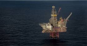
The stimulus package which could revive momentum for offshore EM development might just be provided by marine seismic contractor Petroleum Geo-Services (PGS). Last month the company reported on a successful test on the Peon field, offshore Norway, which claimed to demonstrate for the first time that a towed cable EM acquisition system could provide reliable resistivity measurements over shallow targets far faster and more efficiently than current node-based solutions. The company went as far as to say that the results brought full commercial application within striking distance adding that a towed 3D EM solution would be tested later this year.
Given the track record of offshore EM’s evolution to date, such announcements are bound to be treated with caution. But in this case PGS is inviting oil companies to participate in a joint industry project (JIP) to further test and develop the system and its capabilities in both shallow water and increasing target depths. Dan Whealing, president of PGS Electromagnetics, said JIP partners would get an early look at towed EM data allowing them to evaluate the cost-effectiveness of the technology as it develops.
PGS began researching a towed receiver array and source for EM surveying operations five or six years ago with the Swedish Defence Research Agency (FOI) as a partner, and conducted its first tests of an EM streamer in 2007. It was working on the basis that conventional marine CSEM would always be limited by the complexity and cost of an operation which requires the placement of retrievable nodes on the seabed ahead of a vessel towing a cable across the receiver network. By contrast a towed cable system would be able to cover far larger areas much more rapidly at a fraction of the cost. It also opened the possibility of some kind of combined survey where vessels could carry out both seismic and EM projects as part of the same operation, probably not simultaneously but still more cost effectively than two separate survey mobilisations.
In 2007, PGS purchased MTEM, a spin-off from the University of Edinburgh led by geoscientists Prof Anton Ziolkowski and Drs Bruce Hobbs and David Wright who had been developing a transient electromagnetic system specifically to address the deployment of EM technology for oil and gas exploration on land and in shallow water environments. The method was designed to allow separation of interference associated with the EM airwave from useful EM responses coming from the subsurface, which has always been regarded as a complicating if not irresolvable issue for marine CSEM. A benefit for PGS in the MTEM acquisition was that the technology was unambiguously free from any of the patent issues which have plagued the early development of marine CSEM.
Until now the MTEM buy has been seen as something of a sore point for PGS. The company paid a princely $270 million just before the market for EM began to go soft and the geophysical service providers started to feel the squeeze in their mainstream seismic business. PGS acknowledged that its EM project was going to have to go on the back burner. During the tough times it decided to bet on the introduction of its innovative dual-source GeoStreamer for marine seismic acquisition, which by all accounts has proved to be a major success.
Performance evaluation
The PGS field trial of its towed EM streamer acquisition system took place last June over the Peon discovery in the Norwegian North Sea. The operational objective was to evaluate the offshore performance of the transmitter and receiver system. The geophysicists were more interested in the capability of the system to detect a known shallow hydrocarbon accumulation by collecting EM data with sufficiently high signalto- noise ratio to quantify the resistive anomaly target by means of modelling and inversion.
Acquisition was conducted from a single vessel, towing a 3km long receiving EM streamer at 100m depth and an electric current source at 10m below the sea surface. EM data was measured along two lines crossing the reservoir. The nominal towing speed for the trial was 4 knots and multiple runs were recorded to evaluate repeatability. Analysis of the noise characteristics showed sufficient quality and signal-to-noise ratio of the electric field data for inversion as well as direct detection of the resistive reservoir anomaly.
Bottom line for PGS from the Peon test was that its towed EM system offered a realistic business case for cost effective EM surveying. It also presented a degree of pay-off for the controversial MTEM investment. But existing operators of marine CSEM have no cause for immediate alarm. For a start PGS does not expect any commercial towed EM system to emerge before 2012 and more likely closer to 2015. It is also concentrating on shallow water depths between 50m and 500m where its technology is expected to work best in the first instance, although the company does plan to go into deeper water eventually.
Existing marine CSEM players in fact must welcome the attention that PGS is attracting to EM technology. It enables them to restate the case for the technology and update the industry on latest developments. It is thought, for example, that when the investment climate improves a new more economic CSEM data acquisition system will emerge. There is also the question of whether the efficiency of the survey operation is actually the stumbling block to more widespread adoption. EMGS, OHM and WesternEM are all inclined to argue that the solution lies in being able to optimise more clearly the value of the acquired data: that means better interpretation made possible by integration with other available information such as seismic or well data.
Validation
Meanwhile a recent article in the geoscience publication The Leading Edge evaluating the success rates for some 50 exploration wells drilled on prospects with CSEM data provides some much-needed data validating the CSEM method. The joint study by Norwegian oil company Rocksource and EMGS showed that the average discovery rate for 30 wells drilled on prospects with a significant CSEM anomaly was as high as 70%. In comparison, the discovery rate for the 20 exploration wells drilled on prospects without a significant CSEM anomaly was only 35%. This means that wells drilled on prospects with a significant CSEM anomaly have a discovery rate twice as high as those drilled on prospects without a significant CSEM anomaly.
The study also considered results from 36 calibration studies where CSEM data were acquired over prospects already tested with wells. In this case 95% (19 out of 20) of calibration surveys displaying a significant CSEM anomaly represented discoveries, whereas only 19% (three out of 16) of calibration surveys without a significant CSEM anomaly represented discoveries. A follow up study intends to evaluate the results in light of amounts of hydrocarbons encountered by the exploration well to assess the technology’s ability to distinguish commercial discoveries from non-commercial discoveries.
John Howell, chief technology officer at Rocksource, believes the data published by the study offers increasing evidence that the appropriate application of CSEM data in a portfolio setting will improve exploration drilling success rates in CSEM suitable areas.
EM watchers will also be following the results from a research cruise funded by BHP Billiton Petroleum in May/June 2009 carried out by the research vessel Roger Revelle operated by the Scripps Institute of Oceanography, San Diego to collect marine magnetotelluric (MT) and CSEM data over the Scarborough gas field on the northwest shelf of Australia. The objectives of the experiment were to test new CSEM equipment systems and to provide a comprehensive data set for the study of various modelling and interpretation methods. The Scarborough gas field, jointly operated by BHP Billiton Petroleum and ExxonMobil, is well studied by drilling and 3D seismic surveying and is expected to provide excellent ground truth for the calibration of marine EM methods.
The funding proposal for the project stated that ‘although the industry leveraged academic expertise heavily to establish a successful and vigorous marine EM capability, to this day no fully academic public domain data set over a hydrocarbon reservoir exists. This represents a severe impediment to further development of the equipment and processing, modelling, and interpretation codes by the academic community, as well as restricting an objective evaluation of various common practices, free of contractor bias and conflict of interest. This research project is aimed squarely at remedying this situation by collecting a rich and diverse marine EM data set over a known structure.’
Scripps is where one of the first marine EM researchers of the modern era, Prof Steve Constable, continues to push the boundaries. For example, he was chief scientist for a 2008 industry-sponsored research project in the Gulf of Mexico combining seabed receivers with a towed cable EM data acquisition system for gas hydrate detection and mapping, the follow-up of a previous trial offshore Oregon in 2004 (OE January 2003). Constable acknowledges that the potential of EM survey methods for characterising gas hydrates was first seriously mooted by Prof Nigel Edwards of the University of Toronto many years ago.
It will probably be many moons before detection of gas hydrates becomes of commercial interest to today’s providers of marine EM methods. They are focused on capitalising on what is said to be an encouraging increase in tenders for CSEM projects this year. OE
 Subscribe