How offshore assets are visualized has taken a leap forward with photographic technology that helps to create point clouds. Elaine Maslin reports.
 |
|
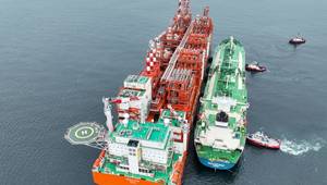
Turning photos into point clouds. Images from Return to Scene. |
How offshore assets are visualized and what can be done with those visuals has been evolving, fast.
When Return To Scene started offering its services to the offshore industry, its tool R2S was based on forensic technology with which investigators could create walk-through, 360° 2D images of crime scenes, or offshore platforms, warts and all, using spherical photography.
Now, as well as being able to virtually “walk-through” facilities, the firm has added a third dimension to its latest offering, called R2S Mosaic, by using trigonometry-based software. Because each pixel now has a coordinate, a 3D point cloud can be created –like a laser scan but without the need for a laser scanner.
This enables users to calculate depth more easily and accurately, automatically tag equipment, where there are engineering or CAD drawings available with location data, and merge with plant design and management systems (PDMS) and piping and instrumentation drawings (P&IDs), etc., aligning photographic point cloud images with engineering and process information, with the user able to navigate between the two systems.
“We have added depth so that every pixel knows how far it was from the camera,” says Martin MacRae, head of product development and support services, Return to Scene. “You can automatically tag things in space if you have the coordinates. Taking measurements becomes easier. Every pixel has a depth, so a lot of user error is avoided and we are challenging lasers.”
 While measurements could be taken in R2S, points had to be selected twice, on the two sets of spherical images which are taken to create the walk-through images. With only one click now required on a point that knows its position relative in space, accuracy is increased and potential for user error reduced. Also, when something is tagged in one image, it is automatically now tagged at that coordinate in every image.
While a certain amount of “washing” might be needed to make sure the design data and what is captured photographically (i.e. what was actually constructed) aligns, this is an opportunity, MacRae says. This is not just for verifying what has been built, but could be useful for modifications or even decommissioning work, and just to help users more easily navigate engineering drawings, by being able to see their as built context.
R2S Mosaic launched at SPE Intelligent Energy, in Aberdeen, last month (September). But, Return to Scene has conducted system trials with clients, including BP. The UK-based oil major will be piloting Mosaic on its Clair Ridge and Thunder Horse assets, in the UK North Sea and Gulf of Mexico, respectively, according to a presentation at SPE Intelligent Energy.
The author says that using the photographic point cloud effectively negates the necessity for laser scanning technology, traditionally required for the generation of point clouds. Searching the images will also be easier now, he adds. Because the images, stored on a secured cloud server, can be merged with PDMS models, searching a piece of equipment will also find the data relevant to it.
 Subscribe