The Arctic hosts harsh environments, minimal daylight and HSE concerns. Anthresia McWashington examines a case study and explains the data acquisition methods necessary to explore in one of the world’s most brutal regions.
Exploration challenges in the Arctic stress the need for more robust methods of oil extraction from these harsh areas. Innovative technology, coupled with more accurate methods of data acquisition, has benefitted efforts to locate and recover more resources from these rigid, wintry conditions located across the globe.
Alaskan North Slope
 Acquisition of seismic data in the North Slope of Alaska can only be executed when there is a sufficient covering of snow in the region. Because of this, the season is limited to the first few months of the year, which drives the need for detailed project planning to maximize and ensure the accuracy of the data recorded.
For years, the preferred method of data acquisition in the region has been seismic vibroseis, which permits data retrieval in deeper targets that form the majority of Alaskan oil and gas production. Now that operators have begun looking at pay zones in the Brookian sectors above the classic plays, high-productivity techniques are required to complete programs of adequate size within the available operations window, in order to image these shallower zones.
The weather challenges of the region dictate the method of exploration. The North Slope has an abbreviated summer, that occurs from July to September, and allows for offshore exploration in the accompanying open water. Onshore exploration can take place beginning around December, and ending around May. During this period, there is a sufficient snow coverage that allows vehicles to traverse the ground without damaging the tundra.
Between February and April 2012, CGGVeritas acquired the first production high density, high productivity vibroseis survey on the North Slope. This survey was executed successfully without increased HSE risk exposure. Some of the goals of the project included improving imaging of the mid and deeper sections these previous surveys had targeted, which meant changing the standard acquisition model used on the North Slope.
Using slip-sweep techniques allowed for an increase in trace density, while keeping equipment and manpower manageable. Slip-sweep acquisitions are common in North Africa and the Middle East, but new to Alaska (Rosemond, 1998, Sambell, 2010).
Data results highlighted the benefits of higher density and wider source frequency range. The source line spacing reduction helped shallow target imaging, while tighter source intervals and smaller arrays preserved high-frequencies and fully sampled the noise. The broadband data, with added low-frequency content, penetrates to deeper targets, improving illumination and thin bed separation through the inversion process (Winter, Maxwell, Schmid, Watt, 2013).
According to CGG, as seismic technology improves, tighter geometries and efficient seismic acquisition should become the norm on the North Slope, delivering better imaging while respecting and preserving the environment.
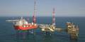
Labrador Basin
Exploration in the Labrador basin is in the midst of transitioning from the shelf to the deepwater region, following the progression of exploration in similar settings. Nalcor Energy investigated how analogues can be used to understand the pressure organization in the un-tapped areas of the Labrador basin in Canada.
The vigorous use of analogues is necessary to understand the pressure history in this frontier area. Analogues can also be used to provide insight into the petroleum system, in terms of seals, migration and fluid flow. Using analogues such as the Mid-Norway shelf to deepwater transition can aid safe drilling within the Labrador basin. Significant discoveries can be made in these deepwater settings, including the deep-sea Nise formation fan reservoirs.
The Nise formation consists of deep-sea fan deposits that are combined locally so that overpressures in the aquifer are the same or similar, and are considered to form part of the hydrodynamic system, despite the deep burial depth. In more stratigraphically-isolated areas of the fans, overpressures can be similar to the encasing shale pressures. These differential pressures, similar to deepwater complexes found in the Labrador region, enhance seal capacity and create opportunities for hydrodynamic trapping— reducing hydrocarbon permeability to near zero. The Base Tertiary Ormen Lange reservoir is hydrodynamic, with a tilted contact, affecting estimates of reserves and development of the field.
Mud weights in several Labrador Shelf wells are low, but there are instances of high kicks taken, suggesting that the pore pressure regime was misunderstood and the wells may have been drilled underbalanced. Many basins in Eastern Canada, such as Jeanne d’Arc, Flemish Pass, and Orphan, are similarly associated with kicks. This approach could possibly be used in the Labrador basins to give an indication of shale pressures, based on picking the seismic Base Tertiary reflector.
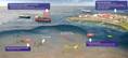
Oil Spill Detection Under Sea Ice
 Arctic freshwater ecosystems’ rapid response to climate changes, over the last 50 years, has caused thinning of lakes and rivers during seasonal ice cover. This increases winter-water supply for industrial withdrawal, and permafrost degradation.
The radar development team at Boise State University (BSU) custom-designed a ground penetrating radar (GPR) system of a higher grade than the commercial products currently available. The new system operates in a frequency range optimized for measuring oil under sea ice with antennae designed to increase the directionality of the transmitted signal.
The GPR project focused on the development of new hardware for higherpowered, directional radar systems that can be tested in arctic field environments using light helicopters. The goal of the project was to expand the operating window for oil detection with GPR, to cover a wider range of sea ice and climate conditions, extending to thicker and warmer ice sheets in late winter.
Tests done on crude oil spilled underneath an artificially-grown 92cmthick ice sheet at the US Army Cold Regions Environmental Laboratory (CRREL) in New Hampshire, and over natural sea ice ranging between 1.7-2m thick off Prudhoe Bay, revealed weak currents within the underlying water body can produce strong anisotropy in the sea ice crystal structure. Containment skirts inserted during ice growth appeared to alter water circulation patterns. Similar effects were also experienced in natural sea ice and were noted for utilization in future radar design and operation.
Following completion of the radar surveys, CRREL personnel recorded the temperature and salinity of the ice, ice thickness, oil thickness, and the distribution of oil through a series of cores and drill holes. When a hole was drilled completely through the sample sheet of ice, it was possible to detect the bottom of the parent ice (at the time of the spill), and the top of the new ice layer, which measured the depth of the oil layer. This made it possible to distinguish between drill holes encountering oil and drill holes that did not.
According to a report from the CRREL, the utility of the system could be improved by developing a third prototype based on what was learned from the trials. Increasing oscillator frequencies and reducing levels at critical mixers will both increase the order of the spurious products, reduce their magnitude—which will move them further from frequency and amplitude regions that could result in false responses. OE
 Subscribe