Polarcus has secured further industry prefunding enabling the expansion of the Capreolus 3D multi-client project offshore Australia.
The additional pre-funding will see the survey expand northwards with an additional 7130sq km to be covered.
The Capreolus 3D Project will now comprise approximately 22,130sq km overall, providing broadband 3D seismic dataset across the Roebuck Basin, offshore North West Shelf, Australia.
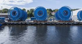
Seismic acquisition on the original program started early January 2015 with two Polarcus A-Class 3D seismic vessels using the Company's RightBAND technique for broadband data acquisition. The expanded survey is now estimated at approximately 12 vessel months duration overall, and will use an additional Polarcus 3D seismic vessel for part of the program. To date, seismic acquisition is about 40% complete (of the new expanded program).
The resultant data from the Capreolus 3D Project will be processed through a pre-stack depth migration routine by DownUnder GeoSolutions in Perth, Australia, with final data products expected to be delivered within 1Q 2016.
 Subscribe