![]()
NEOS GeoSolutions (NEOS) completed a neoSCAN study over an approximately 20,000sq km area of investigation (AOI) along the South Atlantic Margin. As part of this project, NEOS integrated and simultaneously interpreted several existing geological and geophysical datasets to map the regional geology and hydrocarbon prospectivity in an AOI that included both onshore and offshore acreage. The legacy geo-datasets that NEOS analyzed included several airborne geophysical measurements as well as sparsely sampled well and seismic information.
“To accelerate our time-to-delivery and contain project costs in a very large area of investigation, we relied upon existing geoscience data for our interpretation. In a period of roughly 100 days, we were able to highlight some of the key geologic features driving prospectivity in the area and identify the most prospective locations for future exploration and development,” said Chris Friedemann, chief commercial officer for NEOS. “What was most encouraging to us was that, while our client withheld certain data and aspects of their development plan, we nonetheless were able to identify and de-risk several of the prospects that they were planning to drill in coming years. In the current price environment, we are seeing increasing demand for these neoSCAN projects in which our clients extract the most insight from the legacy multi-physics data that they acquired in prior years without the need to commission new and costly data acquisition programs.”
Using existing multi-physics datasets as inputs, NEOS was able to generate project deliverables for its client’s regional exploration team which included:
Unlike the results from most NEOS projects, the results of this survey are exclusive to the oil company that commissioned the project and are not available for license.
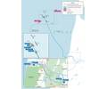
Image from NEOS GeoSolutions
 Subscribe