Mexico’s Comisión Nacional de Hidrocarburos (CNH) authorized CGG to commence a multi-client airborne gravity and magnetic survey offshore Mexico, which will include the acquisition of approximately 200,000km over six areas across the Mexican Gulf of Mexico.
 |
|
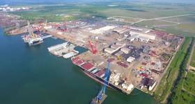
Location of areas covered by CGG’s multi-client airborne gravity and magnetic survey offshore Mexico. Map from CGG. |
Data acquisition will commence in March 2016 and is anticipated to take 12 months utilizing specialized geophysical survey aircraft. The project has received significant prefunding from the oil industry.
CGG believes that the Mexican Gulf of Mexico has significant new petroleum potential, both in the shallow and deepwater areas and that CGG’s ability to image complex geological environments will help unlock that potential. The survey will provide coverage over the most prospective areas from the prolific Perdido fold belt with AOI 1, to the more mature near-shore heavy oil belt with AOI 6. The data will help explorers map crystalline basement and magnetic and density anomalies within the sedimentary section. The airborne survey will also collect continuous data through the “transition zone” from the marine environment to onshore.
A comprehensive interpretation, combining this new data set with available geologic and geophysical data, will also be undertaken by CGG’s in-house interpretation team. Deliverables will include a full geophysical interpretation report, including definition of basement lithology and structure, mapping of sediment fairways and depositional-centers and any intrusives or salt which may be present in the sedimentary section. The final results will be presented in ArcGIS format for assimilation into the clients own seismic, geological and well control databases. These survey deliverables will provide important insights to exploration and de-risking of prospective areas by oil companies.
Jean-Georges Malcor, CEO, CGG, said: "This airborne gravity and magnetic survey offshore Mexico will be a significant addition to our existing gravity and magnetic database in the Gulf of Mexico where we have over 1 million line kilometers of multi-client data. Combined with our other seismic, geologic and satellite multi-client data in Mexico, this new airborne survey will provide a unique geoscience-rich library to support the successful exploration and economic development of this high-potential area for many years to come.”
 Subscribe