New Zealand Petroleum & Minerals, the government's petroleum permitting agency, has released its 2016 Petroleum Exploration Data Pack.
This year’s data pack adds a number of new projects to the comprehensive compilation of open-file seismic and well data, interpretation projects, reports and studies available in previous editions.
The update includes new open-file data for an additional 40 wells, and additional 430,500 line kms of 2D and 37,000sq km of 3D seismic data; the final Fluid Inclusion Stratigraphy Study of ten wells across the Great South, Taranaki, East Coast and Reinga-Northland basins; and a Petroleum Prospectivity Screening Report of the northern East Coast Basin.
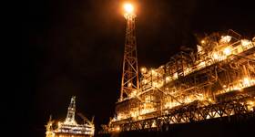
It includes information on the Taranaki, Tasman Frontier, Reinga-Northland, East Coast, Pegasus, Raukaumara, West Coast, West Southland, Wanganui, and Great South-Canterbury basins.
NZP&M Manager Commercial Analysis and Investment David Darby says the 2016 Petroleum Exploration Data Pack delivers an updated selection of our best data.
“This year’s Data Pack continues to build on previous editions. It features a number of recent, high quality 3D seismic surveys within the Taranaki Basin, our only producing basin which continues to attract investment. In addition, we are pleased to feature new insights into the petroleum potential of the East Coast Basin.
“The Petroleum Exploration Data Pack as an essential tool for any investor in our upstream oil and gas sector.”
 Subscribe