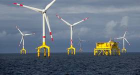
The weather conditions west of Shetland are some of the harshest in the world, even without the help of hurricanes, typhoons and squalls. Elaine Maslin reports on how some companies are attempting to better understand the region.
 |
|
The predominant current patterns, showing the Faroe-Shetland Channel. |
In a presentation about conditions west of Shetland last year, the presenter said the following: “Considerations on Wheatstone (Australia) were cyclones. The Gulf of Mexico is concerned with hurricanes. Indonesia is concerned with typhoons. Scotland doesn’t have typhoons, hurricanes or cyclones. We just have weather.”
The comment is something of wry understatement, particularly as the talk was about the conditions west of Shetland, which, on a good day, are daunting for most. The area is remote and battered by wind and significant wave height.
But, what happens beneath the waves west of Shetland is just as big a challenge, if not greater, and less understood. Ocean currents west of Shetland are driven by the exchange of water between the North Atlantic and the Nordic Seas. According to Fugro GEOS, Fugro’s metocean subsidiary, currents in the area carry about half the total warm water flowing northward in to the Arctic Ocean and about one third of all the cold water flowing out of it.
The current regimes are also extremely complex, and, creating one of the biggest issues facing those wanting to understand what is happening west of Shetland, is that there is a paucity of data, which makes modeling difficult.
Experiencing the conditions for the first time can be a steep learning curve. Speaking at a well intervention seminar in Aberdeen in 2014, Tor Erik Grønlie Olsen, operations manager, at Norway-based Island Offshore, described the firm’s second experience in the area, using the Island Constructor on BP’s Loyal field in 2010, as “horrible” and “difficult,” despite extensive experience working north of the Arctic circle. For Olsen, the sea state is not so much of a problem. “West of Shetland, weather-wise, could be a 365-day area. It is the sea currents under the water that is the show stopper,” he says.
 |
|
A 3D visualization of the channel and surrounding area, by the Department of Mathematics, University of Oslo. Image from Island Offshore. |
The main issues were multiple, multi-directional ocean currents, creating a horizontal force of up to 4-tonne, on umbilicals, for at least 25min/d—on a good day—acting as saw on parts of the vessel. “There are several current scenarios which can, at the worst times, meet up all at once. There are several layers of currents and they are flowing in different directions. It is a really challenging area,” Olsen says.
John Mitchell, metocean advisor at the UK’s Met Office specialist marine center for offshore energy, based in Aberdeen says: “The sea state is pretty well understood and predicted. There is also a broad understanding about ocean currents that impact the west of Shetlands. The challenge is to utilize this knowledge of these broader scale features to drive more detailed predictions of currents of suitable quality to help the offshore industry as it works close to the edge of the Continental Shelf.”
The main oceanographic feature west of Shetland is the Faroe–Shetland Channel, a gorge-like feature, heading south-west to north-east, between the Faroe Isles and Shetland. It is about 1000m deep at its shallowest, reaching more than 1500m deep, and about 200mi wide, with its slopes being less steep on the west side, where it forms the Faroese Shelf, says John Siddorn, head of the Ocean Forecasting Research and Development group and co-chair of the National Centre for Ocean Forecasting (NCOF). Although it is one of a number of deepenings on the Scotland-Greenland Ridge, it is a key feature for understanding ocean current in the area, Siddorn says.
 |
|
The Foinaven FPSO. Photo from Teekay Corporation. |
“It acts as a channel for the cold water flows coming out of the Nordic Seas going south, and (warmer) Gulf Stream/North Atlantic flows going over the top of those to the north, along the Shetland shelf edge (a thermohaline driven overturning of water between the North Atlantic and Nordic seas),” he says. “The top 300m goes along the east side of the slope going north. There is also water coming from Greenland and Iceland coming down towards the channel.”
At 450m-500m below the surface, there is a strong permanent thermocline, marking the boundary between the warm (4°C-15°C) near surface current systems and the cold (-1°-2°C) waters of the south-westward flowing Norwegian Bottom Current, according to Fugro GEOS. This can create an interface on which internal tides have been observed, generating currents up to 0.5m/s, and something breaking down into smaller, non-linear internal waves where it meets the slope.
The large-scale current systems lead to a frontal system, separating the warm and cooler waters, and creating instabilities leading to eddies, deflections, meanders and filament-like jets and squirts, creating strong currents up to 0.7m/s, particularly in the upper part of the water column.
There are also intermediate waters adding to the mix and the area is also very close to the UK Continental Shelf, which is very tidal, creating further interactions. “It is a complex mix of different currents. Where they come together, there is a lot of interaction, including with the sea bed, and all sorts of processes, which make it quite difficult to understand and model,” Siddorn says. “A lot of work needs to be done for us get enough information to fully understand this area.”
 |
|
Left: Three guidewires in 1.24 knot currents during a deployment phase. Right: Damage from one of the guidewires to the lower cursor frame (LCF). The LCF sits in the moonpool area and acts as a guide/protection while deploying equipment through the moonpool and splash zone. Photos from Island Offshore. |
For operators, the area is poorly observed and the data that exists isn’t available in an easily digestible format for planning subsea operations. The complexities make the area inconsistent.
Exploration in the area started in the 1970s, but it wasn’t until 1992 that the first commercial discovery was made, with Foinaven, 190km west of Shetland, in 350-520m water depth, followed by Schiehallion (now part of the Quad 204 project, a redevelopment of the Schiehallion and Loyal fields), 130km west of Shetland, in 350-500m water depth, both of which have been developed using FPSOs.
All are on the eastern upper slope of the channel. Here, according to a July 2010 presentation by the LWI Alliance, including Island Offshore, “the slope current dominates, so that net flow is usually towards northeast, following depth contours.”
The current speed is around 0.3m/s, with tides usually recognizable as modulations about the mean, and seldom reversing the flow. However, eddies can increase the current to up to 1-1.5m/s, usually in the same northeastward direction, but, it says, all directions are possible.
Deeper than 350m, there is a risk of sudden severe currents close to the seabed, associated with internal waves. In deeper waters (500-1000m+), the lower slope’s influence on the current is less strong, which means flow direction can be more variable and eddies can strengthen currents in any direction.
 |
|
Island Offshore’s Island Constructor. Photo by Ronnie Robertson. |
Darren Chalmers, senior operations engineer at Island Offshore, said most of the challenges while working west of Shetland had been in the Schiehallion and Loyal fields, relating to current strength, With the current tending to maintain a consistent direction throughout the water column, however, changes to direction could occur at random depths and for random durations.
Fugro GEOS says the slope current and tidal current on the eastern slope of the channel reinforce each other for one half of the 12-hour tidal cycle and oppose each other for the other half, with the upper water column maintaining a north-easterly direction. In the lower part of the water column, tidal currents can also be overcome so that the current maintains its southwesterly direction throughout the tidal cycle. A strong current could move the end of an umbilical 2-300m from where it needs to be, as well as causing damage to vessels, Chalmers says.
There is a NERC project, called FASTNEt (Fluxes across sloping topography of the northeast Atlantic), which is looking to better understand the interaction between the ocean and the wider UK shelf seas, using gliders, or AUVs, to help gather data.
This would also help companies manage another potential problem, in addition to installation, maintenance, intervention, and decommissioning activities – oil spills. In normal environments, spills would be expected to disperse vertically and horizontally with the current. But, because of the strong density gradients acting as barriers to movements in the water column west of Shetland, this does not necessarily apply. “It would be quite complex to think where any spills might end up,” Siddorn says.
Island Offshore has had campaigns every year west of Shetland since 2009. It has dealt with the situation by quickly learning about the conditions, Olsen says. For the first few years, it used two acoustic doppler current profiler systems, one on the ROV cage and a second hanging off the vessel, to carry out mapping and gain knowledge in the area. The firm also modified its vessels to cope with the demanding environment, including a permanent mud cap system (for well intervention operations), modifications to the hull, tower, handling equipment and additional protection to running equipment, as well as improving operational procedures and training and preparing animations showing equipment and pumping hose behavior in exposed ocean currents to prepare staff. These modifications have also helped extend the operational season, Olsen says.
“All the time we are increasing our knowledge, to see how we can operate for longer. Finding useful information about the current situation outside the current situation we are working in is very difficult because no one is operating there,” Olsen says. “That’s a fact, and we are determined to find more information.”
 Subscribe