Elaine Maslin examines how virtual reality goggles and augmented reality offshore platforms are quickly becoming part of the 21st century oil and gas industry.
 |
|
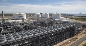
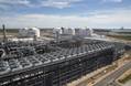
Simulation solutions. Photo from Aker Solutions. |
While it has been a few decades since science fiction films “The Terminator” and “Lawnmower Man” brought augmented reality into our imagination, the technology is now a reality.
Virtual reality (VR) goggles were one of Christmas just past’s popular presents and even the offshore industry has embraced such tools, not least on industry exhibition floors, where you can crash VR drilling rigs, tour the insides of concrete gravity based structures and “fly” around massive subsea structures, without getting so much as your feet wet.
But, beyond the marketing booth, how are companies using such visualization tools in their engineering work? We decided to ask some of the engineering houses. Their responses highlight the fact that these technologies are being adopted across the board. But, it also highlights that they can be used in many different ways, from using gadgets to connect people and data, to creating digital twins of entire platforms as part of a management system or using simulations to minimize operational risk. And, there’s more to come.
Gadget show
Amec Foster Wheeler (AFW) has a strong focus on connecting people with people and people with information, including a real-time visualization of a particular platform, in whatever way and from wherever they want to access it, individually or in remote teams. To do this, the firm uses what it calls an Asset Information Hub (AIH).
“This is a digital representation of the physical plant, hosted by Amec Foster Wheeler, providing a powerful information management solution to control, link, review and deliver almost any type of data or document in a secure environment throughout asset lifecycle,” says Alick Watt, project delivery director, AFW. “The AIH collates all models, documents and data, including functional and physical attributes for all plant items.”
One of the tools AFW uses to access the AIH is Aveva’s “Engage” touchscreen technology, which provides an “interactive window” into the AIH, with real-time links between onshore and offshore, complete with “in context.”
“The combination enables collaborative, effective decision making in providing instant access to data, documents, models and information,” Watt says. “This supports reliable decision-making in both capital projects and operations.”
AFW also uses other gaming-type technology, from virtual reality visors (to enable very convincing first person walk-throughs) to offshore compatible tablets, helmet cameras and Bluetooth technology. Such tools can help prepare staff for work offshore, using a real-time representation of the offshore working environment, but also connect them more easily with those onshore, Watt says. “Recently we used virtual reality to prepare people for an offshore hookup, and we believe this is a first in the oil and gas industry,” Watt says.
Getting social
It’s not all about kit, however. AFW has adopted the social networking service Yammer to improve communications between onshore and offshore, particularly to facilitate collaboration and the sharing of videos and pictures.
Although the kit and development does come at a price, once implemented the cost efficiencies are huge, Watt says. “For example, a direct and real-time link from onshore (anywhere in the world) to offshore (anywhere in the world) has obvious benefits from an efficiency point of view. Jobs can be completed faster, risk removed, with much reduced man-hours and improved safety,” Watt says.
“Engage, which is accessed via a secure web portal, means users have complete visibility of the live project information and documents in context within the 3D model to enhance understanding and promote rapid, effective and collaborative decision making.
Watts continues: “As every tagged object is selectable and is linked to its full contextual information, visual queries can be developed by theme to overlay multiple types of information, from multiple information sources onto the model for simple, instant visualization and greater understanding of the information. This allows experts, wherever in the world they might be, to be instantly connect to problems.”
Visioneering
 |
|
VR vision. Photo from Ramboll. |
Having adopted 3D models in the 1980s, sophisticated digital tools are a standard for Aker Solutions, says Astrid Skarheim Onsum, head of Digitalization at Aker Solutions. “We see visualization technologies as an integrated part of project execution,” she says.
Interactive presentations and animations based on 3D models, which are checked off against laser scans when an existing plant is involved, are used by the firm to optimize designs and visualize complex work scopes.
“We use 3D animation and simulation capabilities to make projects more predictable, reduce costs, mitigate risks, improve product development and better plan complex logistical operations offshore throughout the engineering, procurement, construction and installation (EPCI) cycle for brownfield and greenfield projects,” Onsum says.
Using its own Visioneering system, at Aker Solutions’ Simulation Center in Stavanger, the firm takes operatives and crew through full, life-like procedures, such as crane operations, marine operations or mechanical handling, complete with walkie-talkies and headphones, etc., before they go offshore.
“By visualizing installation plans in an optimal sequence, surprises and late changes are avoided and execution time offshore is optimized and reduced,” Onsum says. As a result, she notes, “all of the complex projects simulated at Aker Solutions simulation center have been flawlessly installed offshore, completed at or ahead of schedule and without safety incidents.”
“A good example is a successful flare replacement project in 2015. Due to the age of the platform, no proper drawings for the old flare were available and the weight was uncertain,” she says. “A scenario with a dynamic center of gravity for the old flare was prepared, enabling simulation of different behaviors when the flare was released. During training, the team gained valuable understanding of the complexity and inherent risk of the planned tasks and was able to significantly improve the work process.”
Such systems are used across the full life-cycle, with interactive 3D models and digital engineering tools used to aid the early engineering process and smart connected systems aiding operations and asset management. “For workover systems, for example, 3D scanning during rig visits can reduce uncertainty regarding the integration of completion and workover equipment onto a drilling unit. We also have smart, connected systems and software products within our asset integrity management services, to more effectively managing integrity and optimizing work processes. A number of other opportunities exist to further develop these concepts.”
VR
Ramboll’s uses 3D data from in-house high definition laser scanning technology to create immersive environments of an existing offshore facility or a newly designed structure.
“The goal is to achieve what appears to be a real-life size, 3D virtual environment, without any boundaries or restrictions where engineers can have the same experience as they would travel offshore,” says Riyaz Ahmad Malik, team leader, Scanning & Survey, at Danish engineering house Ramboll.
The system needs a PC to run the model, a headset to display the model, and head and hand tracking and controllers, which mean the image will appear as it would in front of you even if you move.
Ramboll is using the newly released Oculus Rift headset. “The main advantage of using this system is that all elements required for VR experience are compactly packed in box,” Malik says. “Basically, the system follows a ‘plug and play’ philosophy, with touch tools (wireless controllers) designed to make you feel like you’re using your own hands. To interact with different objects within the model, we use eye-gazing technology, which has a very simple principle: to activate a simulation or to turn on/off any switch you just need to gaze at the icon for a few seconds to stimulate the function.”
Ramboll recently completed a digitalization project in the Middle East, in which 19 offshore platforms were converted to their digital version using laser scanning technology to capture the as-built conditions. The laser scanning point cloud was then converted into 3D CAD models and delivered to the client in VR format. After that, each specialist was assigned with a specific ID and avatar, and all the members of the project team were able to meet on the platform, explore the components and talk to each other.
“VR is also a great tool for spotting potential flaws and risks prior to design implementation,” Malik says. “Currently, we are working on a project that entails developing a fire and gas (F&G) detection mapping system using VR technology. We practically perform a simulation of the coverage areas of each sensor to mitigate the risk of hazardous situations. Not only is it a fascinating experience to actually be on the platform with your team mates, but the technique also enhances the efficiency of overall F&G mapping system by locating blind spots that are not covered adequately.”
Life of field
For Wood Group, asset visualization is as much about information as the actual facility. “We see the value in having access to the relevant information in offshore facilities throughout the asset lifecycle,” says Tony O’Shea, director, Operational Management Solutions, Wood Group.
“Asset visualization provides a multi-dimensional, global collaboration tool for managing the facility with the project team and all involved parties, no matter their location,” he says. “This allows for a collaborative environment, which is key to ensuring engineering design is delivered to specification and is fit-for-purpose.”
Wood Group’s Operational Management Solutions business unit works across the asset lifecycle, creating and developing information within a greenfield environment then transferring, managing and updating it within a brownfield environment, including digital content tagging – of equipment, etc. - providing operations, maintenance and integrity information, as well as design information such as drawings, specifications and dimensional measurement.
“This allows personnel – from the operator to the service company – access to the right information at the right time. For example, if a user wished to see the location of a pump on an asset, they can login online and review maintenance records, operating procedures and spare parts, without having to visit the asset.”
This work goes hand in hand with Wood Group’s dimensional control function, which uses traditional survey techniques, such as electronic total stations, as well as high definition laser scanners and HDR photography to build accurate as-built data of facilities and equipment. These models can be used to compare designs to what was built, then mass captured laser scan data can also be overlaid onto proposed designs to ensure they are clash free and tie into the existing facility.
This can be extended to subsea infrastructure, which can also be virtually modelled to provide a visualization of the whole asset from topsides to subsea, O’Shea says.
Last year, the firm used spherical photography on a processing facility in the Caspian region. Multiple 360° HDR images were taken in and around the facility, with particular emphasis on the work pack locations, in order to identify and read data such as equipment ID tags. The digital capture was then processed and incorporated into asset visualization software to provide a 360° high resolution virtual tour, available online. This was then used to assist in the planning of future engineering work, allowing the operator to update work packs and supporting materials, as well as for pre-visit site familiarization.
“In this project, the software system also included a measurement capability, which ensured the operator and service teams could obtain onsite dimensional data from their desktops,” O’Shea says, allowing the client to increase efficiency, reduce risk, operating costs and downtime. Importantly, it provided a visual portal into operations, allowing engineers to easily and accurately identify priorities. Design teams were also able to work together to access engineering work packs from a common area.”
The future
Where else will new technologies for visualization take us? Watt says most of what has been used today is technology we might already see in our lives, and so not exactly new, just new to offshore.
“However, we are now looking at some game-changing applications and approaches, challenging the status quo to do things really differently,” Watt says. “Some of that means looking at what the gaming industry is doing, and applying that to the real world offshore. We are also looking at some of the most basic elements of offshore processes and working to see what can be done completely differently.”
Malik says there is great potential for VR technology. “Essentially [VR] takes the typical online meetings we already know to the next level, but we should not underestimate it,” he says.
“Looking forward, VR has great potential for training and security simulations, monitoring and emergency scenario applications.”
For O’Shea, there’s a digital transformation underway. “We’re collecting more data than ever before. In the future, we should be able to access information related to an asset at any time and review best practice from other installations in the operator’s portfolio. This will allow for quick data-dependent decisions that are safe and compliant.
“We also see the potential to visit assets in remote locations, reduce survey times, link to equipment remotely via video, condition-based monitoring and drone capture. However, the key will always be controlling and analyzing this information in an asset visualization portal so it can be applied efficiently,” he says.
Augmenting operations
 |
|
Instructions in-situ. Image from Cadherent. |
An Aberdeen company is looking to punch above its weight with technology which could change the way technicians operate offshore.
Cadherent, founded about 10 years ago, started in the engineering and drafting space, mostly geared toward brownfield work. But, a move into using augmented reality has given it an idea that could help streamline plant maintenance.
“About eight years ago, we increasingly found clients looking to improve safety during installation work on modifications,” says David Thomson, managing director. “We started giving them animations about how something should be installed and used. That’s when visualization was brought in. It was an easy step from there to start using augmented reality (AR).”
Initially, Cadherent used AR as a sales tool, to show what it could do with CAD visuals and how these could be visualized within a live video – i.e., if your camera points at something tagged it then imports a 3D visual into the frame which can be viewed in 360°, as if it was actually there.
“Using a portable device, you can look at and manipulate [e.g. dissemble a structure to see how it’s constructed] 3D drawings as they would appear in-situ,” Thomson says. The same could be done wearing heads up display units (or HUDs), with handheld devices (like those used on gaming console) used to manipulate what is within the field of vision.
However, the firm is looking to take these techniques into the operational space. Instead of just using this for visualizing something where it is due to go, it sees the potential for the technology to be used by operators to take them through and record procedures, as well as being able to view PDMS (plant design management system) data, etc.
“Instead of procedures being written, they are visualized on screen and [actions] can be verified by the user, which can include taking a photo. This creates a maintenance record and an auditable trail,” Thomson says. “We would like to see it tied in with SAP (enterprise software) or whatever system the operator is using so it can be part of the plant maintenance, including permits to work and even equipment and materials check lists.”
By using technology such as Google glasses, the offshore technician can also be supported by onshore experts who would be able to view what the technician is viewing in real-time, including overlaid 3D visuals, plant data, etc., Thomson says.
Cadherent is working with Robert Gordon University’s School of Computing Science and Digital Media in Aberdeen, through the Oil & Gas Innovation Centre, to develop its technology. The firm wants to streamline the offshore data capture process and create recognizable targets that the software can spot, and then overlay data such as procedures, PDMS data, etc. It also hopes to work with industrial partners on the project.
Read more:
 Subscribe