|
|
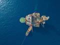
The Cygnus Alpha wellhead platform during installation offshore. Photo from GDF Suez E&P. |
A new impetus to explore the UK North Sea could help to unlock some of the basins’ underexplored plays. Elaine Maslin found out more.
A significant anniversary in the UK Continental Shelf’s (UKCS) exploration history passed by quietly this May.
It was the 1964 enactment of the Continental Shelf Act. Its ratification by the UK Government opened up the North Sea to national and international exploration companies.
Fifty years later, there are more companies in the basin than ever and interest in the latest licensing round (28th) was high, with 173 applications for around 370 blocks or part blocks. But exploration activity has fallen and discoveries are on average less than 20MMboe.
In a bid to boost exploration rates, the Exploration Task Force (ETF) was set up in 2012 by industry group Pilot to promote the basin’s new and underexplored areas and improve exploration well performance.
In addition to the ETF’s work, the Department of Energy and Climate Change (DECC), the Natural Environment
Research Council (NERC), and industry body Oil & Gas UK also sponsored a cross-industry scoping study by SLR Consulting. The study’s aim was to assess how to produce an online, 21st century exploration road map to the UKCS to aid in providing a better understanding of its resources.
The impetus to improve exploration performance is strong—if new discoveries are not made soon, current infrastructure will be removed, limiting the economic chances of future discoveries, Oil & Gas UK and Petroleum Exploration Society for Great Britain president Oonagh Werngren warned.
“We have been exploring here for 50 years, but there are vast differences in understanding between the different basins,” says Oonagh Werngren, who is also operations director at Oil & Gas UK and is responsible for running five different PILOT workstreams dedicated to maximizing recovery from the UKCS, including the ETF.
“Although the central North Sea has been developed, there are still significant resources to be developed, including high-pressure, high-temperature (HPHT), and the western margin of the platform. That area offers the greatest potential for the next tranche of developments, because there is a lot of ullage available in the existing infrastructure and a lot of interest in drilling in that area.
 |
|
The Alpha wellhead platform in place in the Cygnus field. Photo from GDF Suez E&P. |
“West of Shetland is the least mature area, with limited existing infrastructure, but with a lot of prospectivity for the future. The Hebrides and Forth Approaches basins are both under explored.
“The northern North Sea and southern North Sea are two of the oldest basins and were explored very quickly and major fields put online. The upside might be more limited, but that isn’t to say there are not plays to be developed going deeper.”
Some areas are already opening, such as the Carboniferous. It has lower calorific-value gas than the already produced Permian gas, and earlier drill stem tests on it did not flow. “Now we have a better understanding of the geology, the zones that have permeability, and where it offers the greatest production,” Werngren says. As a result, a whole new play in the northern margin of the southern North Sea has been opened up.
GDF SUEZ E&P UK has explored the Southern basin Carboniferous with success and is now developing Cygnus, a significant four-platform development, as a result. “Our view is that the Carboniferous has got a lot more to give,” says GDF SUEZ E&P UK’s subsurface manager Andy Spencer. Typically, reservoirs have been exploited at 8-11,000ft in the Southern Gas basin. GDF SUEZ is now looking at the potential for going deeper.
The reasons why some of these areas have not been fully explored vary. For the northern part of the gas basin, it was the lower calorific-value gas, challenging reservoir quality and higher costs associated with drilling hazards in the Zechstein salt. Spencer says improved seismic imaging from modern 3D surveys will play a key role in identifying new opportunities which were not seen on the existing 20 year old datasets.
In the fractured basement, the issue is about technology, around well completions, and also the depth of such reservoirs, Werngren says. “The basement rock itself has very low permeability, so it is also around our understanding of the additional permeability you can get through fractures. In some areas, it is about the hardness of the rock and our ability to see through it, such as ub-basalt. A lot of effort has been put in to understanding that.”
There is limited interest in the Triassic sandstone in the English Sherwood Channel, south Celtic Sea and St George’s Channel. This is possibly due to the challenges regarding access to the resources, in what is a busy shipping lane. For the latter two plays, the distance to market is another factor to overcome. “Technically, in all the basins in the UK, there are interesting opportunities, but each area has its own challenge,” Spencer says. “In the central North Sea there is a lot of potential for 50MMboe prospects, but there is labyrinthine infrastructure to deal with. You can make a discovery, but making money out of it is not easy.”
Companies are already starting to work more closely together to ensure cluster developments can go ahead, instead of risking stranded fields.
A further initiative, suggested by the recent Wood Review report (OE: April 2014), could see government-backed seismic acquisition to help further understand of some of the underexplored areas.
Meanwhile, research is now under way on how to create the 21st century exploration road map. At a recent PILOT meeting there was industry support for DECC to move ahead with key projects to establish a new understanding of the risks in the basin and some key projects to unlock hydrocarbon play systems. The key will be collaboration from both operators and the supply chain – but we need to act fast. Rising costs are in danger of causing a premature end to exploration,” Werngren says.
 |
|
The Polarcus Naila, which started a 3D multi-client survey West of Shetland in June. The survey will be the industry’s first 3D data over the Brendan basin, in Quad 219, and will cover 2500sq km, says TGS. Photo from Polarcus. |
New/underexplored plays
on the UK Continental Shelf, outlined by Oil & Gas UK
West of Hebrides
Within the west of Hebrides area there are a number of known geologic provinces that include the North and South Rockall basins, Hatton basin, Rockall Plateau and the Hatton Continental Margin.
The Rockall basin is a major component of the rift system, which formed as a precursor to the present Atlantic Ocean. To date there is no conclusive proof of a pre-Cretaceous extensional phase within the Rockall Trough, which would provide the source rock which is required for a working petroleum system to be in place. A viable but rather local petroleum system has been proved for the Rockall basin: in the UK sector, the Benbecula well tested positive for gas while in the Irish sector, tests of the Dooish well established the presence of gas condensate. However, there are vast areas with no wells and very sparse, low quality 2D seismic coverage that remain unexplored.
 |
| Map of the UKCS with the proven and potential Fractured Basement Plays highlighted. Image from Oil & Gas UK. |
One of the main challenges is to establish whether there is a viable petroleum system for other frontier areas including the Hatton basin and Hatton Continental Margin farther to the west. Initial limited exploration of these basins has led to the identification of potentially attractive tilted fault-block plays. The presence and maturity of significant source rocks remain to be proved.
Carboniferous beneath Central North Sea, East Irish Sea and Southern North Sea
Carboniferous reservoirs are usually laid down in deltaic (river delta) or fluvial (river) environments, formed from the precipitation of calcium carbonate. To date, most Carboniferous traps rely on a closure, either dip or fault bounded, at Top Carboniferous but there is potential for exploration of deeper traps.
The Carboniferous in the Southern North Sea provides the principal source-rock interval for the basin but also contains numerous potential sandstone reservoir intervals.
Through analysis of its biostratigraphic profile, marine shale within the Carboniferous can be correlated across large areas. It is possible that these “shaley” units could provide what are known as intra-Carboniferous seals. An example of where the intra-Carboniferous has been proven as a seal is the Boulton gas field (Block 44/21a) which is an anticlinal structure. Gas is trapped by a combination of up-dip seal against Permian shales and salts, and side seal from faults and low permeability Bolsovian sandstones.
Few of these intra-Carboniferous traps have been tested where they are not in combination with a closure at Top Carboniferous. This is an under-explored play type which requires more detailed seismic interpretation within the Carboniferous and further investigation into whether the rock presents the distinctive layers likely to provide potential sealing horizons.
Fractured Basements
Fractured basement rocks are hard, mostly granite formations. Post deposition tectonic events, including earthquakes, try to push and bend these formations, but due to their brittleness they crack, resulting in seismic-scale faults and highly connected fracture networks. Lateral migration from local reservoirs fills these extensive fracture networks with hydrocarbons, meaning that oil production is from the fractures not the rock matrix. This is dependent on the presence of an extensive, open fracture network.
Most basement hydrocarbon plays are hosted in structural highs (either fault blocks or buried hills) which commonly form tilted fault blocks, described as “half-grabens.” Areas of the UKCS with proven and potential Fractured Basement Plays are: Rona Ridge Discovery (Clair, Lancaster, Whirlwind), Atlantic Margin (Rockall Ridge), Cairngorm Discovery, Bagpuss Discovery, Orcadian basins, Cardigan Bay, Mid North Sea High, Irish Sea (Rathlin Trough) and Utsira High (Norge).
New technologies, such as advances in seismic survey techniques used to predict fracture formations, will enhance the industry’s capability to assess the potential of the basement as a hydrocarbon-yielding reservoir. Similarly, areas once considered uneconomical or technically challenging can now be explored, representing a new play concept for the UKCS.
Sub Basalt and Cretaceous sands, West of Shetland
Basalt is an igneous, fine grained rock which can be laterally extensive when extruded as a lava flow. The presence of these shallow, high velocity, highly heterogeneous (continuous) layers can scatter the seismic energy during seismic surveys providing challenges for interpreters of the data. This play concept centres on a deeper cretaceous sandstone reservoir which is difficult to map due to the presence of the basalt layer above, obscuring the seismic imaging of the deeper reflectors.
Through the study of similar rock sequences observed in outcrops onshore, the properties of these sandstones have been shown to be of reservoir quality. Acquisition of additional seismic data and interpretation can better map these sub-basalt Cretaceous sands. The first sub-basalt discovery is the Rosebank field West of Shetland.
 |
| Left: Sub-basalt. Map showing the eastern limits of Palaeocene lava flows in the Faroe-Shetland Basin (purple line) and the eastern limit of the main intrusive sill complex (green line). Sill complex outline modified from Rateau et al. (2013), well and field data from DECC. Right: Conceptual diagram showing elements of the sub-basalt play West of Shetland and West of Britain, after Rateau et al. (2013), Grove (2013), and Helland-Hansen (2009). Images from OMV. |
Southern North Sea High CO2 Gas
The gas in the South Eastern part of the Permian basin in the UK is characterized by unusually high CO2 (carbon dioxide) and N2 (Nitrogen) contents, often referred to as “fizzy” accumulations. This area extends into the Dutch sector and includes several hundred bcf of undeveloped gas.
Although the gas in the Rotliegend reservoirs of the Southern Permian basin is predominantly methane, the area in the extreme south east of the UKCS waters has high inert contents. The ‘Fizzy’ accumulation (tested by well 50/26b-6) contains 50% CO2 and 9% N2. The nearby 54/1b-6 ‘Oak’ discovery has similar high inert contents (36% CO2 and 25% N2). This region of high inert gas content extends into the Dutch sector (Blocks P1 and P2) and is a related to the inverted ‘Fizzy Horst’ structural feature (Yielding et al., 2011).
The key to unlocking this resource is the application of technology that will allow commercial development. This technology needs to address the removal and disposal of the inert content to provide a gas stream that meets market requirements or to allow the efficient combustion of low calorific value gas.
Triassic West of Shetland
Exploration and development of West of Shetland fields are predominantly focussed on Paleocene age reservoirs (such as Schiehallion, Foinaven and Clair). South of these discoveries, well penetrations have discovered Triassic age reservoirs which are older than Paleocene. Two depositional models are relevant for this play. The wetter climate depositional model consists of alluvial fans forming against basement highs during the active rifting phase of the formation of the Atlantic Ocean. The drier climate depositional model is similar but rather than fluvial channels there are aeolian (wind blown) sand dunes and sandflats, such as the Otter Bank formation. The Triassic play concept has been proven in Liverpool Bay, east Irish Sea as well as south of West of Shetland. This is considered a new play as it is under-drilled and little understood.
Permian in the East Irish Sea
The East Irish Sea basin is divided into several sub-basins and highs. The basins were formed by the Triassic rift development of grabens and half-grabens, a characteristic geological feature of the UKCS.
Sherwood Sandstone is a regionally developed system with good quality reservoir rock. This formation accounts for a large majority of the currently proven reserves. The main exploration risk in this area lies with source rock maturation and hydrocarbon migration, most likely in the deepest buried areas away from the location of uplift during the early Cretaceous period.
Traps rely on hydrocarbon migration from younger Liassic reservoirs to older Triassic reservoir through fault juxtaposition. Evaporites (rocks formed by the evaporation of provide good sealing potential but halokinesis (the movement of salt or salt bodies) adds uncertainty to structural modelling and may also hinder hydrocarbon migration.

Oonagh Werngren, Petroleum Exploration Society for Great Britain president and operations director at industry body Oil & Gas UK. Photo from Oil & Gas UK.
 Subscribe