The true potential of AUV capabilities have not been fully realized, according to a technical session at this year’s Offshore Technology Conference. Karen Boman reports.
 |
|
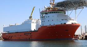
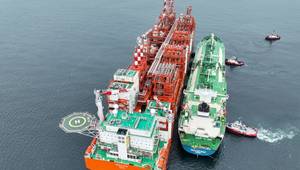
An Oceaneering AUV. Photos from Oceaneering. |
The capabilities of autonomous underwater vehicles (AUVs) have matured, but their full potential for offshore oil and gas operations remains untapped.
Twenty years ago, Andy Hill, global geohazards technical authority with BP, called for the oil and gas industry to adopt AUVs because he believed AUVs offered an effective way to address operational inefficiencies of deepwater survey and the inadequacies of towing equipment; the growth of exploration and production in deepwater and complex offshore terrain; and need for better data quality at a reasonable price.
“Initially, contractors balked at AUVs, believing it would make survey vessels obsolete overnight,” Hill said at the Offshore Technology Conference in Houston this May. But, Hill and BP persisted with their message. As a result, AUVs first became commercially available to the oil and gas industry in 1999. But, it would take a commitment from a contractor outside of mainstream oil and gas to deliver these first AUVs.
After an initial period of experimentation in the early 2000s, the sustainability of the AUV market increased from 2005-2014. During this time, the choices for AUV vehicles for nearshore and deepwater, AUV payloads, and reliability of AUV technology increased. Since October 2012, DOF Subsea says that more than 320 dives yielding 25,000km of data have been carried out, delivering less than 4% downtime on eight different vessels for six different clients, said Leonard Ricketts, AUV offshore manager for DOF Subsea, during the OTC session.
Autotracker technology also has been developed and proven for AUV pipeline inspection, Hill said. This technology is be available. Except for the Caspian Sea, however, oil and gas companies have not adapted this technology for inspection, preferring to stick with existing tools such as vessels and remotely operated vehicles (ROVs), Hill stated. BP is seeking to change that with its 2017 Internal Challenge, where BP aims to cut pipeline inspection costs 50% by 2020.
BP is looking to new technology to achieve this goal. But, companies also need to know how to locate all of their data, the quality of data needed, resolution and repeatability, and gross or centimetric accuracy, Hill explained. The ability to provide instantaneous access to multiyear point data also will be necessary.
Emerging technologies such as machine learning, subsea Internet of Things and robotic swarm technology machine learning could enable automated inspection. The Holy Grail of AUVs – autonomous subsea intervention – has yet to the reached. The technologies to accomplish this feat exist, but operators haven’t consistently pursued them, Hill said.
“Just as 20 years ago it took a contractor from outside of mainstream oil and gas, it may take another company outside of the mainstream” to push further adoption of these technologies, Hill said.
Value-approach needed
 |
|
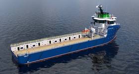
An alternate view of an AUV. |
While technical challenges such as ROV tether management systems created initial interest in AUVs, commercial and quality demands drive AUV survey demand now, Ricketts said. AUVs have proven not only to be reliable, but to be a low-cost solution. However, AUVs are struggling for their own identity, Ricketts said.
In the late 1990s and early 2000s, AUV service providers drove down operational costs so that AUVs would be adopted by the oil and gas sector. While this strategy succeeded, it had a downside. It fostered a cost-based approach to AUV surveys instead of a value-based approach. Because of tight margins, the cost-based approach makes it difficult to invest in upgrades and maintenance of AUV technology, Ricketts said.
The legacy of ‘cost per kilometer’ tendering means that the industry still does not take full advantage of what AUVs can offer, Ricketts and co-author Christopher Ordonez stated in an OTC paper, “Project Cost Reduction and De-Risking with Large-AUVs for Hydrographic and Pipeline Surveys.” For example, many clients still opt to minimize line kilometers by opening up the line spacing to the point where a digital terrain model is only just achieved without any gaps. This forces the AUV to fly at a higher altitude, compromising data resolution.
Companies that own larger class AUV submarines also are often heavily invested in ROV assets, creating indecision for their own business development teams, Ricketts and Ordonez said. This issue is typical of a market in the midst of technological transition and diversification.
“We are at the stage where acoustic pipeline surveys are being executed more efficiently with an AUV rather than an ROV,” Ricketts and Ordonez said. Intervention, repair and maintenance will still be the domain of ROVs for some time. But, at this point, clear market slots for each technology appear to exist. AUVs appear to be making headway in a traditional ROV domain, acoustic pipeline surveys, due to their speed, quality and repeatability.
Ricketts believes that service providers need to make a better case for the values of fully utilizing AUV capabilities. This includes data quality, one of the primary advantages offered by AUVs in survey work. Today’s largest survey class AUVs carry a range of instruments and sensors, including side scan sonar, chirp seismics, multibeam sonar, backscatter, leak detection, high resolution color photography and laser scanning. Data gathered can be seamlessly accepted into the emerging and rapidly advancing technology of data fusion. As a result, powerful 3D visualization datasets such as pipeline photo mosaics draped over high resolution laser micro-bathymetry, can be created.
Due to improved reliability, AUV technology itself is no longer a bottleneck. Going forward, data management and storage must be considered. Ricketts said the biggest possible challenge is creating a data visualization platform that permits the client to work with higher resolution data without investing in expensive software or hardware.
“If people can use their iPhones to look at data, why can’t they do the same with survey data,” Ricketts said of having tools like Google Maps and Google Earth to look up survey data.
Setting records off West Africa
 |
|
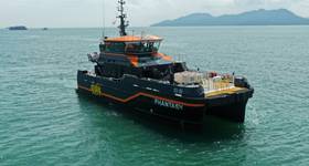
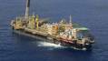
Illustration of ocean monitoring robots. Image from BP. |
Total E&P and Oceaneering officials offered an example of their record-setting use of AUVs in deepwater subsea pipeline inspection offshore West Africa. In recent years, AUV-mounted high resolution sensors such as lasers and subsea cameras, as well as conventional sensors, have become more widely available. These tools allow operators to conduct baseline surveys, field monitoring, and inspection purposes, according to a paper presented by Sébastien Ghis, geomatic & positioning specialist at Total E&P, and Eric Fischer, project manager at Oceaneering, “Record-Setting AUV Pipeline Inspection in Deepwater West Africa.”
For the offshore West Africa surveys, data gathered through both conventional and unconventional sensors was integrated into a geographical information system (GIS), which provided a better baseline picture of the installation and areas that needed to be addressed.
The survey results found that AUVs will not completely replace conventional ROVs in deepwater pipeline survey work. While ROVs can be used to achieved all pipeline inspection work, an AUV’s limited maneuverability means that a horizontal safety distance must be maintained between the AUV and all subsea structures. As a result, the AUV cannot achieve the whole scope of pipeline inspection, and is limited to survey 96% of the flowline/pipeline lengths.
For the large majority of pipeline surveys, however, AUV pipeline inspection surveys not only take five times less than ROVs to collect survey data from the same feature, AUVs pipeline surveys also are five times cheaper than ROV pipeline surveys, and minimize HSE (health, safety and environmental) risk by limiting worker exposure to the offshore environment, Ghis and Fischer said.
“The development of a GIS-based data reviewer in close collaboration with end-users, combined with the use of WebGIS, provides access to a subsea layout with an optimal spatial resolution,” Ghis and Fischer stated. “The data provides solid GIS products for subsea inspection, repair, maintenance planning and further dedicated ROV detailed investigation.” It also provides a database, which could be used for a “time lapse” approach to detect subsea geohazards and subsea equipment modifications over a field’s life.
 Subscribe