The US' National Oceanic and Atmospheric Administration is planning increased 2015 Arctic nautical charting operations, updating charts based on surveys conducted a hundred years ago.
The so-called Arctic marine corridor project will be performed with the Coast Guard to assess the safety of a potential Arctic shipping route from Unimark Island, the largest of the Aleutian Islands, through the Bering Strait to the Chikchi Sea.
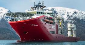
Coordinating with the Coast Guard, NOAA survey ships Rainer and Fairweather and the US Coast Guard Cutter Healy will perform transits to and from the Arctic, covering some 12,000 nautical miles in the Arctic, to collect depth measurements along the proposed shipping corridor.
“Much of our charting data in this corridor is from surveys conducted a hundred years ago,” said Rear Admiral Gerd Glang, director of NOAA’s Office of Coast Survey. “So right now, we need to conduct reconnaissance of the seafloor in high traffic areas to make sure they are safe for navigation.”
Over the past several years, Healy has been collecting multibeam echo sounder depth data while traveling to and from its Arctic research projects. NOAA has reviewed the data, archived at NOAA’s National Geophysical Data Center, and has found they are reliable and can support nautical charting.
Altogether, the ships will collect about 12,000 nautical miles of data along the four nautical mile wide corridor. In addition to measuring depths, they will search for seamounts and other underwater dangers to navigation.
Other work planned for this summer includes joint hydrographic surveys by Rainier and Fairweather in the largely uncharted areas of Kotzebue Sound. In addition, Rainier will survey off Point Hope, Alaska, to evaluate a potential shoal area discovered by NOAA cartographers and researchers using commercial satellite imagery. Fairweather is scheduled to survey Port Clarence, a key Bering Strait location that is of potential interest as an Arctic deepwater port.
 Subscribe