Groton, Conn.-based autonomous maritime security solutions company ThayerMahan, Inc. announced it has executed a cooperative partnering agreement with marine geophysical surveying, data analysis and reporting firm Geo SubSea, LLC.
ThayerMahan CEO Mike Connor stated, “ThayerMahan is bringing best-in-class seabed imaging technology to customers in government, industry and academia that provides a very efficient way to image and map the ocean floor and undersea infrastructure. We are proud to be partnering with Geo SubSea because they are experts in turning seabed monitoring technology into the products needed to ensure safe and efficient seabed development. Together, we will provide the next generation in maritime geophysics and ocean engineering support.”
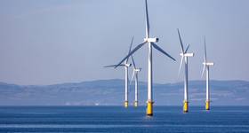
Geo SubSea has extensive offshore surveying experience covering multiple marine survey and marine science fields. The Geo SubSea team has subject matter experts in marine geology, geophysics, oceanography, environmental sampling, benthic and fisheries biology. Additionally, Geo SubSea has offshore wind experience from the inception of the U.S. offshore wind industry in early 2000s and significant experience with high resolution surficial and subsurface sonar data manipulation, interpretation and reporting.
Geo SubSea President, Jeff Gardner stated, “We have been promoting the use of advanced surface and undersea technology for years in the offshore wind industry, and it is now coming of age as a force multiplier in a number of maritime sectors as well as becoming more cost-effective. This technology combined with Geo SubSea’s extensive offshore survey experience in marine geophysics, geotechnical, and environmental disciplines, as well as our post-survey technical capabilities that support all aspects of data analysis and product development, are a perfect complement to the ThayerMahan team.”
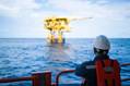
Founded by retired Navy Vice Admiral Mike Connor in 2016 to promote the use of unmanned autonomous systems for the U.S. Navy and other government entities, ThayerMahan provides high-speed, large swath, precision, low-cost seabed surveys from vessels -large and small. ThayerMahan also operates and deploys the SeaScout system, a synthetic aperture sonar (SAS) imaging and survey suite providing range-independent high-resolution (up to 3cm x 3cm) imagery at survey speeds up to 8 knots.
 Subscribe