The National Oceanic and Atmospheric Administration (NOAA), part of the US Department of Commerce, announced yesterday the start of the 2014 hydrographic survey season. New data collected will increase coastal environmental intelligence around the country.
NOAA ships, small boats, and hydrographic services contractors have their sailing orders to survey more than 2000sq nm in US coastal waters this year, collecting data that will strengthen the foundation of the nation’s environmental intelligence. Most of the vessels are sailing to their initial project areas now.
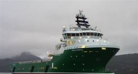
[Top image: NOAA Ship Rainier and its six small survey boats return to Alaska for a summer of hydrographic surveys (photo: NOAA).]
The NOAA Office of Coast Survey will manage and conduct surveys that will measure water depths and collect ocean floor data so the agency can update its nautical charts, identify navigational hazards, support wind farm sitings, map ocean habitats, and assist state governments with their ocean projects.
“Accurate data are absolutely necessary to engage in informed discussions and make sound ocean policy,” said Holly Bamford, Ph.D., assistant NOAA administrator for NOAA’s National Ocean Service. “Whether it’s a ship loading exports for overseas customers, or a city planning to strengthen coastal resilience, industry and government require the strong foundation that coastal environmental intelligence provided by our hydrographic data and charts offers.”
Protecting vessels, and the people who sail them
Protecting life and property at sea is the major objective of the hydrographic survey program. Since vibrant tourism and commercial fishing industries mean more traffic on the ocean, NOAA ships Rainier and Fairweather will gather hydrographic data to supplement old and sparse depth measurements on nautical charts covering Alaska's Kodiak Island. Rainier will also work in Cold Bay, Alaska, charting approach areas where ships can take refuge when the harbor’s currents are too strong. NOAA has also contracted with TerraSond to survey Bechevin Bay, the easternmost passage through the Aleutians from the Bering Sea to the Gulf of Alaska.
NOAA contractor C&C Technologies will survey in Louisiana, offshore of Barataria Bay, to acquire the data needed to establish turnoffs and turning basins for large vessels. Leidos will survey the approach lanes to Mobile Bay, Alabama, to increase shipping safety there. Another contractor will survey the approaches to Lake Borgne and Lake Ponchatrain in Louisiana, where nautical charts still display depths measured in the 1800s.
On the East Coast, NOAA ships Thomas Jefferson and Ferdinand Hassler will survey an area offshore of Rhode Island Sound to identify a safe route for deep draft oil tankers. The Coast Survey Research Vessel Bay Hydro II will survey critical areas in central Chesapeake Bay. Coast Survey's six navigation response teams (NRTs), small two or three person boats equipped with both multibeam and side scan sonar systems, are acquiring data to address possible charting discrepancies ‒ data that is outdated or wrong ‒ and other concerns. This year’s plans include data acquisition in or near:
San Francisco Bay, San Pablo Bay, Suisun Bay, and Richmond Harbor, California, to address charting discrepancies and other concerns
Carquinez Strait (Anchorages 22 and 23), near Benicia, California, to chart a shoal that has migrated toward the federal shipping channel
Galveston Bay, Texas, and vicinity, in response to requests by pilots and port authorities
St. Andrew Bay’s Grand Lagoon, Florida, to investigate shoaling and a changing channel course
West Bay and West Bay Creek, along the Intracoastal Waterway north of Panama City, Florida.
a proposed anchorage area near Jacksonville, Florida, to investigate reported hazards to navigation.
 Assisting with coastal planning investigations
Ocean planners need to base their investigations on sound data. The NOAA Ship Thomas Jefferson and a navigation response team are surveying in Long Island Sound to provide data to the multi-state, multi-agency Seafloor Mapping Initiative. The Thomas Jefferson will also collect data that scientists need for essential habitat mapping in Fishers Island Sound, Connecticut. Measuring ocean depths and characterizing the seafloor is an essential preliminary step when governments and industry consider offshore sites for wind turbines.
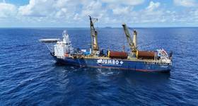
Bottom image: In one project, NOAA Ship Thomas Jefferson will survey in Long Island Sound, performing essential habitat mapping in Fishers Island Sound, and continuing Post Tropical Cyclone Sandy hydrographic surveys that were started in 2013. photo source: NOAA.]
The Hassler will survey a possible site in the approaches to the Chesapeake Bay, and another possible area offshore of Rhode Island Sound.
The Hassler is also surveying off the coast of Portsmouth, New Hampshire, collecting data that will contribute to habitat mapping and the state’s effort to locate sand resources for beach replenishment.
 Subscribe