Andrew McBarnet detects a rebuilding of industry confidence in marine controlled source electromagnetic surveys after a troubled period for the operators of the technology.
It is now almost exactly 10 years since a somewhat historic scientific research cruise to West Africa hosted by Statoil effectively launched a new discipline and a significant business opportunity in the offshore E&P industry. The trip in the presence of the world's leading experts in the field fulfilled its mission of proving the potential of controlled source electromagnetic (CSEM) surveying as arguably the most valuable geoscientific contribution to the E&P toolkit since the emergence of 3D seismic in the 1980s.

As has been chronicled in this column, events since CSEM first burst onto the scene have been turbulent to say the least. The main participating companies in the new business saw their market value at one point rise to nearly $2 billion, fuelled by speculative money betting on a misapprehension about the extent of CSEM's ability to accurately locate the presence of hydrocarbons in the subsurface, which some over-enthusiastic, not to say disingenuous, marketing did nothing to dampen. The inevitable deflation, coinciding with a worldwide recession, was so severe that the two principal independent CSEM contractors, Electromagnetic Geoservices (EMGS) and Offshore Hydrocarbon Mapping (OHM) barely survived, while Schlumberger's WesternGeco quietly withdrew from active survey operations.
A squabble over patent rights to the CSEM method pursued by EMGS epitomised the misery of the day as it simply fed into the reluctance of many oil companies to adopt what was perceived as a possibly promising but unproven technology.
But having weathered the storm of those overly high early expectations and the subsequent low of disillusion when CSEM was no longer viewed as some kind of panacea for explorationists, there are increasing indications that the role of CSEM is becoming better understood and as a result the seas ahead should be easier to navigate.
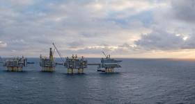
It is not entirely clear why industry perceptions about CSEM have turned more positive so quickly. From an operational point of view, EMGS as the leading survey contractor was showing every sign of continued struggle last year with no good financial news to report to investors. Now it is building an impressive backlog and taken on a third vessel to fulfil outstanding contracts.
In the case of OHM, lack of survey business obliged the company to sell off its acquisition arm to a separate company owned by previous OHM shareholders, Euro Trans Skips and the somewhat illstarred Sector Asset Management. In a separate development a month or two ago Sector had to say goodbye to its 80% investment in Bergen Oilfield Services, the small and irretrievably over-extended Norwegian marine geophysical contractor which went bankrupt.
In the OHM restructure, there is now a public company trading as Rock Solid Images (RSI). This is the name of the Houston-based geophysical interpretation services provider taken over by OHM in the boom year of 2007 to broaden its technology offering and develop future CSEM-related applications focusing on integration with other subsurface data. Meanwhile Aberdeen-based OHM Surveys has been established with access to two vessels providing 2D and 3D CSEM and magneto-telluric acquisition services to the upstream oil and gas industry in all water depths ranging from 30m to 3000m. The company, not surprisingly, has been nominated as RSI's preferred provider of CSEM services should it have a role in generating such surveys with its clients. Indications are that after a long hiatus, the company is in line for acquisition projects in southeast Asia and West Africa, again suggesting that things are looking up.
It may be that the commercial troubles experienced by the CSEM survey contractors especially in 2009/10 were more a reflection of the prevailing economic climate rather than anything inherently wrong with the technology. Oil companies were holding up on E&P investment in general, and in such circumstances they were hardly likely to make a relatively untried technique such as CSEM one of their priorities. It is also the case that the main adopters to date have been major oil companies and NOCs: in other words, an exotic luxury not usually considered an option for your average exploration company.
Issues had of course arisen about the value of the technology. Early successes attributable to use of the method, notably the string of massive deepwater discoveries by ExxonMobil off West Africa, did lead to over optimism. There was an understandable impression that CSEM would evolve into an exploration tool in its own right like seismic acquisition applicable in all sorts of environment. In fact EMGS has developed a stand-alone multi-client model for large area frontier-type CSEM surveys which it calls scanning. The first such survey was undertaken offshore India in 2008 ahead of the country's seventh licensing round, and since then there have been multi-client surveys in the Gulf of Mexico and offshore Norway in the Barents Sea in connection with its 20th and 21st licensing rounds. The idea is that the resistivity information acquired by the scanning process using sparser spreads of receivers on the seabed can help oil companies to better select the prospective blocks, most likely already identified by conventional 2D and 3D seismic imaging.
It is certainly arguable that the technology stumbling blocks perceived by the industry have simply been growing pains. The CSEM method seemed to establish that EM energy can map resistivity distributions, potentially identifying responses associated with hydrocarbon reservoirs lying beneath the seabed.
Yet, for all the early surveys undertaken for ExxonMobil, Shell, BP etc, there was very little public domain information by way of case studies. Contractors therefore found themselves frustrated in their attempts to build a market for the service by the restrictions put upon them by their clients. At the same time the sceptics could have a field day. Just as an example, doubts were expressed early on about the effectiveness of CSEM in water depths shallower than 100m because of the ‘air wave' (airwave interference from signals interacting with the atmosphere). Yet that discussion completely evaporated once contractors demonstrated that they were on top of the problem and surveys in much shallower water depths could be undertaken. More fundamentally, it became clear that the value of this new data type was not being fully exploited because it was not well understood: there was no roadmap for interpreting the data and then creating an earth model where the information was integrated with seismic, well, and other data.

One thing CSEM technology has badly needed is some good PR from its clients. An article published this year in the EAGE publication First Break by authors from Statoil must be helpful in this context. It was essentially through the auspices of Statoil that CSEM originally evolved out of academia to become a commercial application for the E&P oil and gas industry. The company gave birth to EMGS, by far the most active contractor in the field, and as a consequence is firmly committed to the technology with a 10 year-long record of commissioning CSEM surveys. For instance, it very recently ordered a new high-resolution, full-azimuth 3D CSEM survey data for continued research purposes in the Barents Sea.
The survey was to be performed by the Atlantic Guardian using densely sampled receiver grids, thereby providing high-res data.
The Statoil authors decided to analyse their database of some 60 CSEM surveys up to 2009, mainly carried out for prospect evaluation. Happily, they observed a ‘tremendous development and improvement during these years of all elements from acquisition and processing to data analysis and interpretation techniques'. They noted that the accuracy of the measurements has improved substantially, and the number of receivers has increased from typically about 20 in 2003 up to 140 or more in 2009. While early surveys were mainly 2D lines, 3D surveys constituted more than 90% of the CSEM market in 2009. In addition, processing techniques have moved CSEM from a deepwater method (more than 1000m) to a technique which today is applicable for water depths of only 100m or even shallower. The interpretation workflow now includes geological model building and modelling and inversion as standard.
Despite their positive view about the effectiveness of CSEM data, the Statoil team effectively acknowledged that this is a work in progress. They look forward to ‘further improvements of measurement accuracy, acquisition configuration, and source strength accompanied with more accurate modelling and inversion tools will allow for detection of deeper and smaller targets in areas where the geology is more complex. In addition to improvements of CSEM data quality and analysis, increased experience in using integrated interpretation will be of crucial importance for exploiting the information in the CSEM data in a more precise manner. In this respect, using seismic structural information and rock physics to make more quantitative predictions of a target will be essential.'
In these conclusions Statoil's CSEM experts are very much on the same page as Dr Lucy MacGregor, now chief technology officer of Rock Solid Images but someone who was involved in development of CSEM in academia before becoming a founder of OHM. Dr MacGregor is currently on a European lecture tour for the SEG on ‘Integrating well log, seismic, and CSEM data for reservoir characterization'.
In a sense the title says it all. It presupposes that the best results from CSEM will be achieved when its data are integrated with well log and seismic data for starters. If this is indeed the case, then the logical conclusion is that the initial emphasis on CSEM for use principally as tool for de-risking exploration has turned out to be misguided.
MacGregor suggests that if only a single data type is considered, ambiguities in the interpretation can remain. So, well logs provide a highresolution measurement of the properties of a reservoir and the surrounding strata; however, properties can only be determined in a small area local to the well. Remote geophysical measurements such as seismic are therefore required. But seismic on its own cannot provide the complete picture. It has known interpretation issues: basically it can determine the reservoir structure but potentially not its content or extent.

Meantime CSEM provides resistivity well logs which often show that commercial hydrocarbon deposits may be many times more resistive than surrounding lithologies. However, MacGreor points out that despite the sensitivity of resistivity data for determination of saturation, the structural resolution of CSEM data is poor. Also, the cause of resistivity anomalies (particularly high-resistivity features) cannot be uniquely linked to the presence of hydrocarbons in the subsurface when taken in isolation. In many situations, these are equally likely to be caused by other high-resistivity material (for example tight carbonates, salt or volcanics).

This is why the real appeal of CSEM may be shifting towards the extra information it can provide around a target reservoir in an appraisal or monitoring role. The risk factor of not being able to interpret the results of a CSEM frontier exploration survey is likely to be high. If the exploration CSEM is guided by some prior 2D or 3D seismic then the outcome should be more predictable. The scenarios where the most value can be obtained from CSEM data are when 3D seismic and well results can be added in, as is the case with appraisal or monitoring surveys.
In a study with BP, RSI has shown that changes in the fluid properties of a reservoir can be mapped using repeat CSEM surveys, without the need for permanently installed systems. As long as each survey collects high quality CSEM data, it was found that source and receiver re-positioning between surveys is not as critical compared to the seismic equivalent.
Current developments in the CSEM field are increasingly focused on how to effect successful integration of all the methods that can measure and calibrate the subsurface. In future this could bring in gravity data which measures density and magneto-telluric data which can measure the earth's natural magnetic and electrical fields to provide subsurface resistivity models often to depths of 10,000m or more. All this is a major challenge that implies among things that successful CSEM acquisition projects need careful modelling from the get-go in order to constrain the surveys with all relevant data.
Reflecting the general trend, SEG has pushed the boat out with its IQ Earth project launched 18 months ago to ‘initiate concrete discussions to nurture the creation of a fundamental change in visualising and predicting subsurface structure, rock and fluid properties; driven by renewed focus on multidisciplinary integration and the new quantitative earth model paradigm; applied by the next generation subsurface scientist'.
Dr MacGregor's company RSI is leading the WISE (well integration with seismic and electromagnetic) Consortium in a three-year project to develop novel methods for the integrated interpretation of seismic, CSEM and well log data within a rock physics framework, to provide quantitative measurements of subsurface rock and fluid properties, hopefully leading to improved reservoir characterisation. RSI has also positioned itself as an independent consultancy source for companies in all aspects of CSEM data – processing, interpretation and integration with other data – using its rock physics expertise. It is winning an increasing amount of business from companies wanting to reprocess their existing CSEM data hoping to extract more value from the range of services RSI has to offer.
EMGS is moving in much the same research direction as RSI, working with companies in the Fugro Group, with which it has an alliance. Fugro, for its part, last month acquired AOA Geophysics. In the acquisition announcement Fugro referred to marine oil seep exploration and the interpretation of geophysical data in complex ground conditions, including gas hydrates.
In collaboration with the Scripps Institution of Oceanography, AOA introduced commercial marine MT (MMT) services for hydrocarbon exploration objectives in 1995 and now offers a complete MMT service including survey planning, data acquisition, data processing, and interpretation.
Some will recall that AOA's affiliated company AGO worked closely with ExxonMobil to pioneer and commercialise the application of CSEM as a risk-reducing technology for offshore hydrocarbon exploration before being acquired by Schlumberger in 2006 and being absorbed into the WesternGeco EM division.
It may therefore not be stretching a point to suggest that the clearer focus for CSEM research and development – also reflected in projects at academic institutions such as Scripps, the University of Southampton, Imperial College and Edinburgh University – may be instilling more industry confidence in the technology.
Interest is definitely picking up again. Developments to look forward to in the not too distant future include the launch of the much anticipated towed-EM acquisition system from Petroleum Geo-Services (PGS) and the outcome of the joint industry project between EMGS and Shell to produce the next generation CSEM acquisition system including source, receiver and positioning systems. OE
 Subscribe