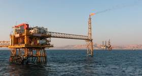
Despite depressed oil prices, the Gabonese 11th deepwater licensing round has generated considerable interest from both international oil companies (IOC’s) and newcomers alike, encouraged by the success of exploration in the conjugate margin offshore Brazil, as well as recent pre-salt discoveries such as Ruche, Tortue, Diaman and Leopard in nearby Gabonese waters.
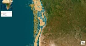
French geoscience firm CGG has worked directly with the Direction Generale des Hydrocarbures of Gabon (DGH) to acquire and process over 25,000sq km of new 3D BroadSeis multi-client seismic data over available and licensed blocks in the South Basin to enable evaluation of this prospective area.
A fast-track pre-stack time-migrated dataset for this survey is available now, along with sample pre-stack depth reverse time-migrated (RTM) data in one area, with the final RTM for the whole of the survey area due to be available this summer.
The survey's objective was to image potential prospective structures at base salt level without compromising the shallower post-salt image quality. "The data do not disappoint," says CGG. "Even a preliminary ultra-fast-track dataset produced onboard was described as 'way beyond expectations' by a major oil company interpreter."
On the full fast-track dataset, more detail below the salt is being revealed than has ever been seen before. Early seismic imaging results indicate the presence of thick syn-rift and sag sequences below the salt, which are the key intervals of a pre-salt petroleum system and indicate many exciting prospects, some of which continue beyond the borders of the survey so that their full extent cannot be gauged.
"The uplift in subsalt imaging that will be achieved in the final dataset is dramatic," says CGG.
Multi-layer tomography (TomoML) and full waveform inversion (FWI) are being used to create the final velocity model, with RTM being used in the velocity model building iterations.
Although this dataset delivers unprecedented images of the subsurface in this area, additional data are being acquired to improve the imaging still further in the most complex geology to the southeast of the survey.
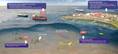
Tailored multi-vessel survey design is enabling longer offsets, up to 14km in the same orientation as the original data, to be acquired over block F14. In block F15, adjacent to the Congo border, a second orthogonal azimuth of the full range of offsets, including those up to 14km, is being acquired.
Longer offsets and dual azimuths are expected to improve the sub-salt illumination and provide even greater clarity of the most challenging structures. In order to acquire these long offsets an additional source vessel is being deployed. Synchronized source technology and blended acquisition are being used to enable the shot interval to be less than the record length, so that source density, and therefore fold of coverage, can be maintained.
All the survey data form the centerpiece of an integrated geoscience project. CGG says integrated studies are becoming increasingly popular as they provide a single validated source for information and each individual part is improved by understanding the requirements of the larger project.
 Subscribe