The role 4D seismic plays in extracting more oil out of mature fields was outlined at ONS 2014 in Stavanger, Norway. Meg Chesshyre reports.
 |
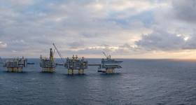
| Fig. 1: 4D seismic gives a clearer reservoir image. All Images from PGS. |
Oil production peaked in the late 90s both in Norway and in the UK, explained Jan Erik Reinhardsen, CEO of marine geophysics contractor Petroleum Geo-Services (PGS), but at that time oil companies started to experiment with 4D seismic, also called time-elapsed seismic, or repetitive use of 3D with time difference over producing fields. Statoil was the global pioneer here, but now this is applied in many of the major basins around the world. It is also one of the tools used to increase production from mature fields. 4D seismic is now routine with proven benefits for improved oil recovery, with better 3D seismic data needed as a basis for further improvement (Figure 1).
Increasingly now, when the reserves are smaller, it becomes very critical to hit the right spot. “We all know the reluctance to continue to drill as soon as you have a dry well in the area…Going forward we have to be much more sophisticated about how we plan our future.” There is, therefore, a need for much more long term analysis driven by better subsurface understanding. This subsurface understanding will then drive improved utilization from the reservoir.
PGS, in 2007, launched its multi-component broadband solution, GeoStreamer. This measures not only the pressure response, but also velocity. “By adding a lot of data in a complementary way we are able to create a broadband picture of the sub-surface. Multi-component is much more than broadband. We are actually able to use this technology in 4D. It is replicable, which is not the case for all broadband technologies.
 |
| Fig. 2: Clearer subsurface imaging using PGS' GeoStreamer. |
“What we started to see is images that look more and more like a photographic image of the subsurface as opposed to seismic images that are difficult to read for a non-scholar. We started to get responses from 2-200 hertz, and for those of you with stereo interest, this is kind of the hifi of the seismic world. We get the treble and the base. We get the full spectrum and it starts to look like a picture.” GeoStreamer has revolutionized subsurface imaging-giving a much clearer subsurface image (Figure 2).
The first company to use GeoStreamer in the North Sea was Lundin Petroleum. This in part led to the discovery of the giant Johan Sverdrup field, in an area where several majors had drilled previously and had not found the reservoir. Reinhardsen quoted Lundin exploration manager Hans Rønnevik: “We were thinking completely differently, and that led to the breakthrough. We used a new technology developed by PGS, called the ‘GeoStreamer’ – a cable towed behind the vessel – and covered the entire area. That was absolutely crucial to understanding the field.”
Reinhardsen added that complete wavefield imaging (CWI) gives clearer near surface imaging. CWI is a proprietary workflow for near surface velocity model building and imaging. It uses primaries, multiples and refracted waves accessible via GeoStreamer dual-sensor recordings. He gave an example showing the extra detail available (Figure 3). Another example showed a slice of a well that came in dry drilled with conventional data. Using more refined GeoStreamer data clearly shows why the well came in dry (Figure 4).
 |
|
Left: Fig.3: Complete wavefield imaging. Right: Fig. 4: Legacy well revisited. |
Reinhardsen put in a plea to operators not to let the current focus on cost reduction result in using less sophisticated technology. “Don’t let cost reduction be about downgrading what you want to look at before you place your well.” He saw this as a very expensive way of cutting costs, which could leave to the premature abandonment of fields. Using more sophisticated methods could also result in only one survey being needed rather than five, leading to an enormous saving of time, perhaps a season or two in the North Sea, not to mention interaction with fisheries and the environment. “Are we seeing a sub-optimal use of seismic by not using the latest available technology, and the question of course, is can governments accept that you can get sub-optimal resource utilization?”
He said that for permanent monitoring different fields would have different cut-off points. It made more sense if there was long-term production, although there was a technology trade-off here. “The day you put the spread on the seabed, that’s the spread that you have to live with for the next 20, 30 years... If you see what’s happened with seismic streamer technology over the last 30 years, I would not like to have that 30-year old technology on the seabed.”
 |
| Fig.5: Advantages of joint EM/seismic. |
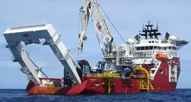
In Brazil, PGS installed a pilot permanent reservoir monitoring system for Petrobras on the Jubarte field in 2012. This involved the installation of 35km of OptoSeis Marine cable with 710 4C sensors deployed over 9sq km. PGS is about to do the third monitor. The quality is fantastic with high repeatability on the data. An extension for this project is now out to bid, and four more projects are expected to come out bid this year. “It is a small market, but a market that is clearly now starting to kick-off and bring results.”
He also posed the question: will towed streamer electromagnetic (EM) take 4D seismic even further? Will this be an additional 4D tool that can add further independent information to understand what is left of the reservoirs. “We have a system here where we can tow an electromagnetic streamer together with a seismic streamer and get a very efficient data acquisition out of that.” (Figure 5)
Petroleum Geo-Services is a 20-year old global seismic acquisition company, headquartered in Oslo, with a comprehensive R&D program of NOK 400 million a year, which is significant in relation to the size of the company. It has a significant library of 600,000sq km, which is the size of the state of Texas. It holds more than 40% of the 3D in Brazil for instance. It has invested NOK 10 billion in vessels and equipment since 2007.
 Subscribe