Several Caribbean countries are embroiled in bitter maritime border disputes. Sarah Parker Musarra examines the history behind two of Latin America’s most-monitored maritime clashes.
 Research vessel RV Teknik Perdana was conducting a multibeam seabed survey on the deepwater Roraima exploration block offshore Guyana on Oct. 10, 2013. Contracted by Texas-based independent Anadarko, on behalf of the Guyana government as part of their 2012 agreement, the vessel soon found itself in unfriendly waters when an armed Venezuelan Navy vessel, the Yekuana, “obstructed the research vessel’s passage, requested them to change course and stop surveying,” according to a statement issued by the Republic of Guyana’s Ministry of Foreign Affairs.
The Teknik Perdana’s crew insisted that it was within the boundaries of Guyana’s economic zone; the Venezuelan Navy, however, did not agree. It maintained that the vessel was within Venezuela’s economic zone.
Image Source: Maps courtesy of Sebastián Machado.
“One point is clear and that is that the RV Teknik Perdana was in Guyana’s waters when this incident took place,” Guyana’s Ministry of Foreign Affairs maintained. The crew was ordered to pick up speed and sail to Venezuela’s Margarita Island. The 285-ft survey ship’s 36 crew members were held onboard while Venezuelan authorities investigated. A statement was later released by the Venezuelan government saying that the vessel was performing unauthorized work on the disputed waters.
According to Guyana’s Ministry of Foreign Affairs, “[it] was then clear that the vessel and its crew were not only being escorted out of Guyana’s waters, but were under arrest. These actions by the Venezuelan naval vessel are unprecedented in Guyana- Venezuela relations.”
 The Guyanese government held fast to its position that there were still many more steps involved before hydrocarbon production can begin, and that the survey was innocuous in nature.
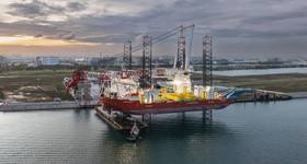
Image Caption: The RV Teknik Perdana was detained by the Venezuelan Navy.
Image Source: [email protected]
The statement continued, calling the action “a serious threat to the peace of the sub-region.” The strong move made by the Venezuelan government was the result of hundreds of years of strained relations between the two countries.
The disputed area is known as Guyana Esequiba, and its boundaries have been contentious since the mid-1800s, when Great Britain set out to delineate the borders of then-British Guyana. The government presented the newly-defined boundaries to Brazil and Venezuela.
 In 1840, German surveyor and geographer Robert Schomburgk investigated and created the Schomburgk Line as a starting point for the neighboring governments to begin talks. He saw the Essequibo River as a natural boundary, and the UK claimed all territory west of this boundary. According to the US Department of State Office of the Historian, Guyana’s territory was augmented an additional 300,000sq mi as a result of the Schomburgk Line.
Image Caption: This series of maps, provided by Sebastián Machado, illustrate the various sides of the Colombia-Nicaragua maritime border dispute and were used for illustration purposes by the International Court of Justice.
The government of Venezuela protested, wanting control of the mouth of the Orinoco River. Their protests went ignored by the British; in turn, Venezuela swiftly severed diplomatic relations in 1876, turning instead to the US.
In 1881, Venezuela suggested a new boundary, and appealed to the US that the UK had violated the Monroe Doctrine. The offer of arbitration was the extent of the aid offered by the US.
By 1895, the situation reached crisis level. Then-US Secretary of State Richard Olney insisted on creating an Arbitration tribunal to settle the matter. Although grateful, the Venezuelan government decried as unfairly biased towards the UK. The tribunal ruled in favor of the Schomburgk Line.
 An already-tense situation was made worse when the mining and oil potential of the Essequibo River was made apparent. Venezuela tried to resettle boundaries again in the 1960s, and this time the country was under a deadline: Independence from the UK was imminent for Guyana. On Feb. 17, 1966, the Venezuelan, British and Guyanese governments signed the “Agreement to resolve the controversy over the frontier between Venezuela and British Guiana,” which, rather than strictly defining boundaries, only established a regulatory framework to resolve these territorial issues. The parties never agreed to a solution. Guyana adhered to the 1895 arbitral award; Venezuela still did not agree.
Article V of the 1966 treaty reads: “No new claim, or enlargement of an existing claim, to territorial sovereignty in these territories shall be asserted while this Agreement is in force, nor shall any claim whatsoever be asserted otherwise than in the Mixed Commission [a commission defined in the treaty to resolve this matter] while that Commission is in being.”
Several uprisings and periods of unrest followed. In 2011, Guyana appealed to the UN Commission on the Limits of the Continental Shelf (CLCS) to extend its continental shelf by 150nm. The Venezuelan government protested, saying that the extension fell into the disputed zone, and referred to the 1966 treaty.
 Meanwhile, TDI-Brooks International was contracted by Anadarko to perform the survey and had three employees onboard. Following the Teknik Perdana incident, TDI-Brooks International Director of Operations Peter Tatro said that operations have not changed, but counted it as a lesson learned.
“We certainly don’t want to do anything that puts our people or assets at risk. We would be reticent, very cautious to approach anything unless we had some confidence that there wasn’t a dispute at play. We don’t want to borrow trouble,” Tatro said. “We are much more informed to the sensitivity of the nature of the dispute. We want to be cautious, out of respect for the countries [as everything else].”
Others, however, see the incident as more far-reaching. Although the US Energy Information Administration lists Venezuela as having the second-largest proven oil reserves in the world at 211 billion boe, operators might refuse to get involved in the Guyana Esequiba.
“Operators cannot be sure the rights given by one country José Molina will be respected by the other. Besides, Venezuela’s record regarding respect for business and property rights is not particularly good,” said José Molina, a professor at the Universidad del Zulia, in Maracaibo, Venezuela. “[Operations in the affected area] probably will be paralyzed unless there is an agreement between the two countries regarding oil exploration and production.”
 Coincidentally, the Teknik Perdana sails under the Panamanian flag, the country at the heart of the history between another maritime border dispute in the area: that between Colombia and Nicaragua.
Although nothing as drastic as ships being detained has occurred in the countries’ disputed area, as exploration continues into new frontier areas, industry eyes are on the two Latin American nations.
On March 24, 1928, at the height of what Mark Jones, Chair of the Department of Political Science at Rice University, called “the era of gunboat diplomacy,” the two countries signed the Esguerra-Bárcenas Treaty, in which Nicaragua recognized Colombia’s sovereignty over the Archipelago of San Andrés, Providencia and Santa Catalina. The 82nd meridian west was set as the division between the two territorial waters.
It was not recognized as the deceptively simple resolution that it is, the primary reason being the US-occupation of Nicaragua at that time. The US held a presence in Nicaragua beginning in 1909, while José Santos Zelaya, of the Liberal Party, was president of the country. Following the execution of two Americans during an attempted overthrow by the Conservative Party, formal occupation by the US began in 1912.
 “This was when the US was throwing its weight around with military intervention,” Jones said. “Many Nicaraguans, particularly on the left, believe the US pressured Nicaragua to sign the treaty.”
Later on, Nicaragua’s Sandinistas fully renounced the treaty. Another factor set the stage for future complications, according to Sebastián Machado Ramírez, professor of public international law at Universidad de los Andes, Bogotá.
“Colombia held it was a maritime delineation, and Nicaragua held that it was not. The court [agreed with Colombia],” he said. “Nicaragua denounced the treaty and … the treaty wasn’t valid because it was signed under coercion.” The Nicaraguan government also claimed that Colombia and Nicaragua’ economic zones overlapped. Nicaragua had no proof, but they filed nonetheless.
In Ramirez’ paper on the subject entitled, “The Colombia – Nicaragua territorial and maritime dispute: sailing through murky waters,” he explains:
 “The law governing the extension of the continental shelf is found in customary international law as reflected in Article 76(1) of the CLCS…In other words, coastal states are entitled to claim a continental shelf the size of the natural prolongation of its land territory or 200nm, whichever is longer.”
“It’s a ridiculous application,” To this day, I don’t understand how the Nicaraguans came to file [with the United Nations International Court of Justice (ICJ), Hague] with the coasts being 400mi. apart. It was quite embarrassing.”
The court ruled against Nicaragua in the delineation of the borders, and Colombia won its sovereignty claims.
As to the claims in the economic zone, the ICJ ruled relative to the coastline, which Ramirez said was consistent in situations such as this. The archipelago and the coast were ruled Colombian territory, but the court modified the north-south boundary following the San Andres to run east-west.
“At that point, Colombia lost some islands,” he said. It should be noted that Colombia did not lose sovereignty: only economic rights.
Ramirez explained: “In the case of islands, however, the overlapping entitlements originate not only from the relevant coasts but from the rights over the sea that are derived from the property over the islands. Falling back on the principle that islands, no matter how small, generate the same maritime rights as other land territory, Colombia argued that all of its high-tide elevations were entitled a territorial sea of 12nm.”
Ramirez said that, in his opinion, the loss wasn’t “that significant.”
Colombians were enraged to lose any territory whatsoever. “They didn’t understand the technicalities of maritime law and the public thought we lost territory. The government [capitalized on] it,” Ramirez said, explaining that it soon became a very political issue.
Colombian President Juan Manuel Santos withdrew the country from the ICJ, even though Colombia is still expected to comply with the Hague’s directive. Nicaraguan President Daniel Ortega ordered his military to prepare for conflict with Colombia, exacerbating the issue. In return, Santos ordered the Colombian Navy to continue patrolling the waters belonging to Nicaragua.
 Jones said that the perceived loss of territory hit the Colombians very hard.
“Any territory is still a loss. From a sovereignty perspective, it would lose sovereignty over a relatively large area of Caribbean – 30,000sq mi. From a nation-state point of view it is a loss,” he said. “The loss of Panama is still very fresh in the minds of Colombians.” While Jones doesn’t believe that the situation will escalate into military action, there are consequences nonetheless. He explained that, because the political structures of Nicaragua and China are similar, Ortega is turning to the Chinese for petroleum exploration and development.
“At least the potential is the hope that the Chinese will help him with exploration and development with any hydrocarbons found in the area. The Chinese are more willing to go into these areas based on strong political ties with this government and would be willing to risk action by the Colombians,” Jones explained. “Even if the petroleum resources don’t pan out, it grants you greater access to fisheries and a greater area under your control.” OE
 Subscribe